Sunday, September 2, 2012


Grand Canyon Rim-2-Rim Hike

This Blog Contains Videos of My Backpacking Trip Down the North Rim of the Grand Canyon Via the North Kiabab Trail to the Top of the South Rim Hiking Up the Bright Angel Trail.

To remember my backpacking experience I decided to use a Hero GoPro video camera to record the event.


The trail leading to the bottom of the Grand Canyon is called the North Kiabab Trail. It begins at an elevation of 8,000 feet above sea level. The trail switches back and forth among evergreens and cottonwood trees till it reaches the Phantom Ranch and the Colorado River. Three inches of dust coats the trail for the entire 14 miles to the ranch.  The dust cushions the impact to the knees making it a pleasant hike.  The north rim trail is shaded much of the hike.                


Only 15,000 people are granted permits out of 70,000 applicants to hike and camp in the Grant Canyon  each year in the months of May and September. The three of us were granted the permit to hike and the permit had to be displayed attached to the pack at all times.  


The trail up the south rim of the Grand Canyon is called the Bright Angel Trail.  It is maintained with cross logs and rock wanes to help the mule trains navigated the trail safely. The temperature at the bottom of the Grand Canyon the day before was 120 degrees and 102 degrees that night. I hiked out from the campsite the next morning at 4 AM to try to get through the hottest part of the trail before the sun reached its highest point around 1 PM.


Some of the best views of the canyon can be seen from the south rim trail. Many tourist hike to the Indian Garden Campground and back for a 10 mile hike.

And make straight paths for your feet, lest that which is lame be turned out of the way;  but let it rather be healed.  Hebrews 12:13 

Monday, August 6, 2012

     
Backpacking Rim-2-Rim Grand Canyon Arizona
                              Part 2
Many people ask me why I would ever consider backpacking the Grand Canyon, and I answer by saying, "Because it is one of the many great wonders of the world that was created by God." We often get so bogged down with the every day routine of work and family life that we take for granted the great things in nature that God has created for our enjoyment. It is exciting to walk some of the same trails that our  pioneers and first explorers walked many years before. I also feel a special kinship with them when I put on a backpack with all of the necessities of life such as food ,water, shelter, clothing, and hike in much the same way as they did in the beginning. The excitement of knowing that if you hike into the canyon you must hike out because there is no other way out unless you are seriously injured. You are on your own. A helicopter port is located at every campground and at selected sites for the "bumblebee" copter ride out for the injured.  I also enjoy meeting and talking to fellow hikers along the trail. They come from all over the world to hike the Canyon. No matter what language they speak we all have the beauty of the canyon as a common bond.

Phantom Ranch

I ended Part 1 staying at the Bright Angel Campground near the Phantom Ranch. My two hiking companions and I stayed two days at the campground. The ranch is the only overnight lodging below the rim. It has eleven rustic cabins and two dormitories along the banks of Bright Angel Creek surrounded by cottonwood trees. A canteen serves home-cooked meals; showers and flush toilets add a touch of luxury.  The ranch acts as an overnight station for rafters and mule riders. Reservations for the ranch are accepted 13 months in advance and sell out within a few hours on the first day on January. I applied for a camping permit for the three of us for a end of May hike. Approximately 70 thousand people apply to overnight hike for the months of May and September,  and only 15 thousand are accepted--most of which are overnight hikers coming down from the South Rim. Not many people hike from Rim-2-Rim. 

                                                       Bright Angel Campground
                                     (photo was taken by Arnold Leonard)
   
There is a T-shaped metal pole on the left side of this picture, and it is designed for the hiker to hang pack on the top to keep animals from getting into it. The biggest problem are the ground squirrels. Ground squirrels look like tree squirrels but they live in holes in the ground and can jump high for long distances. They often jump up to the hanging packs and raid anything that is not in a metal container. I saw one squirrel jump onto a hanging pack, disappearing under the flap only to reappear within minutes with a chocolate cookie in its mouth. Most of our food was keep safe from animals in large military metal ammunition boxes provided by the campground. Each campground had national park rangers who provided care and guidance and evening programs to campers and lodge members. The campsite was great but the flush toilets were not working, and we had to carry water from the nearby stream to flush it after each use. The ranger explained that the rocks do a lot of shifting and tend to cause a break in the pipes supplying water to the ranch and campground. Sometimes when a water line runs along the trail a waterline breakage can wash out part of the trail. One such wash out did occur, and it washed out over 50 feet of trail. Fortunately we were already past that point in the trail. Some hikers were less fortunate and had to back track back to the beginning the trail.

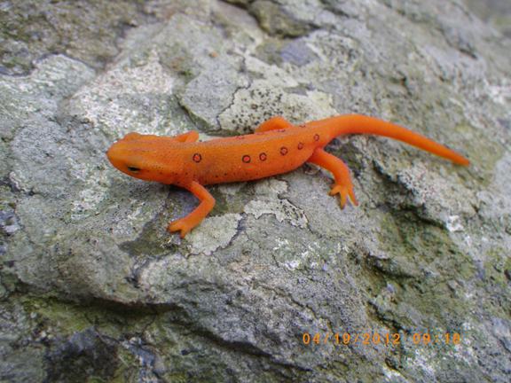
                                           Ground Squirrel looking for a hand out.

We hiked around the Phantom Ranch onto the Clear Creek Trail. This trail climbs high above the Phantom Ranch at several advantage point overlooking the Colorado River. Views of the South Kiabab and Bright Angel Trails can clearly be seen from this point. I sat on a large rock and watched as the mule trains carrying up to twenty riders slowly made their way down the South Rim. I could also watch the whitewater rafters float down the river. The Colorado River is a pretty green with very little silt in it because of the two dams on the river above and below the canyon.

                                 
                                                  Wooden Deck Suspension Bridge


 If you look closely you can see the trail that carries mule riders down the South Rim.


                                                              Crossing Bridge

There are two suspension bridges one metal and one wooden. They cross the Colorado River from the South Rim.
                                                            Colorado River

At the right edge of the river you may be able to see some rafters who have stopped to visit the Phantom  Ranch (2,400 feet above sea level). The trip began on top of the North Rim at 8,250 feet above sea level.

                                                                      Tunnel

All mule riders coming to the Phantom Ranch from the South Rim via the South Kiabab Trail must come through a short tunnel in the rocks before crossing to the Colorado River. 

                                                  Mule Train mule fitted for riding 
                                               (photo taken by Hezekiah Goodson)

Can you imaging riding a mule and having to squeeze through this tunnel?  Most mule riders are given an hour long presentation by the mule team leader on what to expect and how to ride a mule. I overheard a mule team leader telling one young teenager that the mule she was riding liked to hug the outside of the trail next to the drop off. I know that probably did wonders for her confidence in riding mules on a skinnny trails.

 
The temperature in the Bottom of the canyon is 120 degrees
(photo was taken by Arnold Leonard)

The temperature at the bottom of the canyon is usually 20 to 25 degrees warmer than at the rim. At night it was 101 degrees with no air circulation and was a very dry heat. We were encouraged to sit in the Bright Angel Creek during the day to keep cool. As soon as we got out of the water we  dried very quickly.

                                                                  Indian Ruins

Native American tribes of the Hopi, Havasupi, Navajo, and Southern Paiute inhabited the Grand Canyon around A.D. 1300. There are many ruins from their existence near the Phantom Ranch along the Colorado River.

                                                                The Box

In order to get to the next campsite-- Indian Garden-- we had to hike through "The Box." The Box is a narrow canyon with high rock walls on both sides. Temperatures in the canyon can reach  dangerously high levels in the Box if it is not passed before noon. Many hikers start well before sunrise to be sure to get through the canyon on time. It was strange seeing groups of hikers with their headlamps on bouncing past our campground like little fireflies at night. We left at around 5:30 AM and had no trouble getting through it. If you look very closely you can see the trail at the bottom of the canyon. 

                                                               Sunrise shadows

I loved hiking in the morning, watching the sunrise cast shadows of one canyon wall onto another.

                                                                South canyon trail

The Bright Angel Trail leading to Indian Garden Campground was very easy to walk on because it consisted of a loosely packed weathered sedimentary soil. At no time did we have to rock scramble or walk on loose boulders. The trail was easy for mules to walk upon. The mule train guides were very proud to say that they have never lost a tourist or riding mule in the history of mule trips.

                                                        Indian Garden campground

Indian Garden Campground was the last overnight stop before we reached the South Rim--the end of our backpacking trip. The campground was an oasis of green in the desert. Native Americans settled here because there was an ample supply of water and available food to eat. The Grand Canyon is a desert with hot and dry conditions without the sand-like environment you see in traditional deserts on television. We always had access to water along the trail and didn't have to worry about dehydration.


The next morning at 4:00 equiped with headlamp on I left to get a jump start before the sun came up. I was well into the last 5 miles before the sun came up. The last 5 miles was loaded with people of all nationalities hiking down from the South Rim. Many people like to hike several miles down the rim just to get an idea of what it is like to hike the Bright Angel Trail and to be able to say they hiked the Grand Canyon.


                                        Hiking through one of the tunnels along the trail.
                                              (Photo taken by Arnold Leonard)


Along this section of the trail there are warning signs to help keep hikers safe.


At the end of the trail at the top of the South Rim.


A happy smiling finished backpacker!

Isaiah 40:4-- Every valley shall be exalted, and every mountain and hill shall be made low: and the crooked shall be made straight, and the rough places plain.

The Following Photos Taken by Arnold Leonard


Saturday, July 14, 2012

Grand Canyon Rim-2-Rim Backpacking Arizona
                            Part 1

Preparation

It takes a lot of preparation and prayer to plan for a backpacking hike across the Grand Canyon. There are two times a year that the Grand Canyon National Park service will permit campers to hike the Grand Canyon rim to rim. Most of the camping facilities are open in the spring and the fall. May and September are the permitable months of the year. Two friends and I decided to try for the May hiking window. We could choose any days from mid-May through the first week in June. We decided on the four days from May 23 to May 26 but left it open for any four days in the permitable season. I applied on the first day of January for the May hike.  We finally were granted a permit to camp May 26 through May 29. There are no permits required for day hikes. You may make any day hikes you wish, but you must complete the hike in one day. Many people trail run the entire 25 miles from rim to rim in one day, and a few even run the trail rim to rim to rim in one day. We could have hiked the trail in three days, but we stayed an extra day at Phantom Ranch to do a few day hikes. One of our other hiking friends advised us to do it that way. 

The Plan Summary

We flew from the east coast to Phoenix, stayed the night, rented a car, and drove to the Grand Canyon the next day. We then drove to the south rim and spent the night.  The next day we took the shuttle to   the north rim and spent the night at the North Rim Campground. The next morning we got an early start at  5 AM. We hiked to the Cottonwood Campground, approximately 7 miles, and stayed the night. The next morning we began again at 5 AM and hiked 7 miles to Bright Angel Campground,. We spent an extra day at the Bright Angel Campground. The fourth day we hike 5 miles to  Indian Garden Campground an oasis half way up to the south rim. The last morning I left camp at 4 AM because the previous day's temperature was 119 degrees, and I wanted to reach the south rim before it got too hot.  This was a 5 mile hike. That day we showered, changed into travel clothes, and returned the rental car to fly back home.

Detailed Trip


The flight to Phoenix was uneventful except the metal zippers in my convertible hiking pants set off the metal detectors, and I had to be searched. I checked my suitcase at the ticket counter. My theory was to put my empty pack into my suitcase and load everything else on top of it. That way if the suitcase was searched they could put everything back into the suitcase without much disruption. The plan worked great.  When I got to the south rim campground I repacked the backpack and left the suitcase in the rental car. The shuttle the next day cost $85 per person and took about four hours to reach the north rim campground. 


                                                        South Rim Mather Campground


                                                        North Rim Shuttle


The north rim shuttle carried around nine passengers.  Of the nine passengers only the three of us were hiking rim-2-rim. The other passengers were running the trail in one day. They planned to start at 4 AM the next day and  finish at 4 PM the same day.


Some people take the mule ride to the bottom of the canyon. The riding mules are kept apart from the pack mules by cutting their tails differently. The riding mules have a staggered cut tail and are trained for a much different ride than the pack mules.


After spending the night at the North Rim Campground my two hiking friends and I started at 5 AM the rim-2-rim hike on the North Kaibab Trail, which is around 8,000 feet .


The trail was about two to three feet wide and about two inches of deep dust. It was easy hiking and the dust cushioned my knees. Photo taken by an unnamed hiking companion.


We traveled through the Supai Rock Tunnel and saw the Roaring Springs gushing from the side of the canyon high above on the wall of rock.


The first night we stayed at the Cottonwood Campground about 7 miles down the trail. We were amused half the day by lots of 3 to 5 inch long lizards puffing out their colorful necks and doing more push ups than Rocky could ever think about doing. Much of the trail from this point on is paralleled by Bright Angel Creek. 


The next day after a short hike we took a detour to Ribbon Falls about 3,720 feet in elevation. This day's hike was 7 miles long, ending at the Bright Angel Campground near the Phantom Ranch at 2,490 feet in elevation. 


Before we could reach the Phantom Ranch and Bright Angel Campground we had to go through The Box. The Box is part of the Bright Angel Canyon--a very hot part of the trail, and we had to get through it before the hottest part of the day from noon to sundown.


This a picture of the pack mules at the Phantom Ranch. All supplies had to be packed into the ranch and Bright Angel Campground. The ranch canteen had the best ice cold lemonade and served a great beef stew. This photo was take by Hezekiah Goodson, Jr.


This is Bright Angel Campground. A T-shaped pole in the background was a futile effort to stop ground squirrels from getting into our packs. Ammunition boxes were provided at each camp site to protect our food from wild animals. Photo was taken by an unnamed hiking companion.

The next part of the journey will be on my next blog Part 2.

Thursday, May 3, 2012

An Overnight Hike on the Appalachian Trail Near Waynesboro, Virginia

A Small Look Into The Window of Creation


Backpacking has always been a love of my life ever since I was born. I was born a second generation Polish American in the northern part of Virginia.  I grew up in an old converted log cabin with very few modern conveniences. We had an outside spring for our water source and an old shaky privy for a bathroom. The outdoors was my play area. This may sound like I lived in any shelter along the Appalachian Trail but I didn't know I was any different until I started attending public school. That is why I love to backpack because I can still relate to  life the way it was when I was growing up. I feel almost insulted when someone tries to tell me that all of the living and nonliving things around me were created by mistake or by natural selection. There can be only one way that all of the beautiful plants, animals, and geologic features were created and that is by God.

A Short  Hike

One Thursday a friend and I decided to take a short five mile hike to a shelter, camp out, and hike back the next day. It had rained the day before enough to encourage many flowers to bloom the next day. Many red, pink and white flowers gave me an extra lift and a quick to my steps. The air was crystal clear and I knew in a moment that we were in for a pleasant two days on the trail. We passed many hikers along the trail and many of them were hiking long distances and a few could be considered thru hikers. We are both hammock backpackers and after hanging our food on the bear pole  it only took minutes to erect our shelter. The temperature that night dropped near 40 degrees testing our skills on keeping warm. we enjoyed the hike and looked forward to hiking again soon. I am trying to get into shape for my rim-to-rim hike of the Grand Canyon at the end of May.


Fire Pink 


Wild Geranium


Rue Anemone


Salamander


AT Shelter


Pack Hanger


Stream Near Shelter


Hennessey Zipper Hammock


Camp Privy


Haunted Cabin Remains

"Very early in the morning, while it was still dark, Jesus got up,  left the house and went to a solitary place, where He prayed." Mark 1:35


Friday, February 17, 2012

Stripped Bass Revisited


Me and My Fish


When I was a small boy I loved to study the life and habits of fish. I graduated from college with a BS in Biology and later a MS in Environmental Sciences and obtained a successful career in environmental engineering and marine biology. My masters thesis centered on the age and growth of the stripped bass Morone saxatilis in and around the James River and Chesapeake Bay.  About a dozen of the members of Grove Avenue Baptist Church every year go stripped bass fishing around the mouth of the Chesapeake Bay. This year on February 10, 2012 I had the privilege to attend this fishing trip. It was like going to see some distant fish relative  I had not seen for years. Once again I would have the chance to be reunited with my stripped friends from days past. Due to the Chesapeake Bay Conservation Act we would be allowed to keep two fish each for food. Stripped bass in the Bay are called rock fish.  Before I go into the details of my fishing trip experience let me tell you a few facts about stripped bass.


Fish Lesson


Stripped bass are anadramous fish living in saltwater and going up freshwater rivers to spawn or lay eggs.  A 50 pound female may lay up to 5,000,000 eggs in one spawn. The most important variable in determining when the fish spawn is water temperature. The best temperature for fish to migrate is between 57 to 71 degrees. This fact will help you understand my fishing experience later. After the eggs hatch the young fish return to the saltwater for two years to grow. The stripped bass makes two migrations in the spring and the fall to return up the freshwater rivers to spawn. They are usually 30 inches in length for the first migration. At this time they have a ferocious appetite and will eat just about anything in their path but prefer other fin fish. December and January are good months to fish for the strippers as they swim upstream in the rivers. The adults may live for up to forty years and reach a weight of 100 pounds. But the norm is about 10 years old for males and 20 years old for females. An average female may lay 850,000 eggs with each spawn.  On an average a 15 inch fish may weigh 2-3 pounds and be 2-3 years old, a 30 inch fish may weigh 11-16 pounds and be 8-14 years old, and a 45 inch fish may weigh 30-45 pounds and be 15-30 years old. You can determine the age of these fish by looking at the rings on a fish scale like the annual rings on a tree. When I was doing my research on the stripped bass I aged about 10 thousand fish in and near the mouth of the James River. I usually took 4 to 5 scale samples per fish. That is a lot of looking at scales under the microscope. I became very familiar with my new friends. 


How do we determine where the best fishing spots are going to be to catch the biggest and best fish?  I have been told that you are only allowed to keep two stripped bass on each trip and there is only a catch and release requirement within the Chesapeake Bay boundaries.  Your best bet is to fish during the two upstream spawning migrating of spring and fall. Stripped bass tend to be in shallower waters at this time. The warmer the water the deeper they will go. The best time might be in December, January, or February. Look for feeding birds circling on top of the water marking a spot where birds are eating fish scraps left from the hardy appetite of the stripped bass. Fish during the first 3 hours of an outgoing tide or the last 3 hours of an incoming tide. Look for the turbulent water indicating that there are large masses of fish movement below the surface. The strippers feed the best in a temperature range of 40 to 75 degrees. If all else fails have your caption of the boat turn on his fish finder to spot the fish movements.


Fish Story


Back to my fish story. I was thrilled to be able to be with a bunch of Christians on a boat fishing for my "days gone by" friends of the past stripped bass. Two church friends picked me up about 4:15 AM to travel to a Virginia Beach for a 7 AM boat launch. We traveled in the boat north to the mouth of the Chesapeake Bay. The air temperature was around 25 degrees. It was a large fishing boat with a closed in cabin to warm up in when we got cold on deck. When we reached the spot the boat made a continuous circle with the fishing lines trolling behind. We used lures because these fish are so hungry that they will bite at anything that looks similar to a fish. We trolled at several spots for several hours without any luck catching fish. We gave up on catching and keeping the fish to eat and decided to go into the Bay to catch and release fish to get the thrill of catching a big fish. Again with no luck. By this time it was getting late and we decided to call it quits and headed home. On the way back to the dock the motor in the boat quit. The captain had to radio for a tow back to the dock. We got back to the dock no worst for ware. Some of our party stopped off at a seafood restaurant to be able to at least eat some stripped bass even though they could not catch any fish.


Why didn't we catch any fish?


We went fishing in February toward the end of the fish migrations at the time when the weather has been unseasonably warm. Spawning fish like to travel in cooler temperatures. The fish sensing warmer weather approaching moved faster up the rivers to spawn leaving fewer in the coastal areas to catch. The group usually books the fishing boat well ahead of time in order to reserve it during the fish spawning times. Like all fishing trips there is no guarantee that you are going to catch fish. The group leader said that he has been doing this for ten years and this is the first time he has never caught any fish. If I am invited back next year I want to prove that I was not the unlucky banana (bananas were consider unlucky to take with you on a fishing trip).


I enjoyed the fellowship of christian men and women on this fishing trip and would do it again in a heart beat.


Isaiah 19:8 The fishers shall mourn, and all they that cast angle into the brooks shall lament, and they that spread nets upon the waters shall languish.


Thursday, January 19, 2012

Two Short Hikes

Day hikes can be very rewarding during the winter. I just completed two hikes of five miles each. What a better way to start a new year than to take a nice quiet walk in the woods and also what a better way to start getting into shape than to begin hiking during the coldest day of the year. I did just that by taking a five mile hike around the Wintergreen ski resort on new years eve and a five mile circuit hike in January during 22 degree temperature and a 0 degree chill factor. Let me share these hikes with you:


Wintergreen New Year Eves Hike


I was treated to a stay in a condo at the Wintergreen resort ski resort.  Several slopes were open but I preferred to hike on the trails around the resort. Virginia has had an exceptionally warm winter this year with very few snow falls and a mild weather. The ski slopes that were open were maintained with man made snow. I had purchased a new GoPro movie camera and I was eager to try it out.


                      The resort perimeter hiking trail crossed several streams with waterfalls.


Video of the hiking trail waterfall at Wintergreen Ski Resort
                                                                                                

Humpback Mountain Cool  Hike

I like to start each years hiking in January. The winter weather becomes a real challenge with freezing temperatures and lots of precipitation. I can usually be on a hiking trail in an hour and a half from my home. The Blueridge Mountains are almost in my back yard with lots of circuit hikes as well as the Appalachian Trail (AT). Sometimes I begin the season with an 8 mile loop of  the Humpback Rocks and the AT trails. I began the hike at 7:30 AM and the temperature was 22 degrees where the car was parked at the base to Humpback Mountain. The wind was so strong that as soon as I opened the door it blew everything that was loose in the car into the woods. I estimated the chill factor to be around  0 degrees. I was prepared for the cold temperatures. I wore hiking boots with a synthetic sock and a wicking wool blended sock on top. I had hiking pants with short gaiters to keep the wind out. A long sleeve synthetic shirt with a down vest was topped off with a hooded wind breaker. A polartec Mountain Hardware over the ears hat and gloves completed my hiking clothes. It snowed off and on during the hike but I never got cold and I wish that I could have hike longer. It was a very enjoyable hike.


On top of Humpback Rocks


A hike to the top of Humpback Rocks.

Direct my footsteps according to your word; let no sin rule over me. Psalm 110:133