Saturday, October 29, 2011

Bad Branch Falls State Nature Preserve

The Bad Branch Kentucky Nature State  Preserve

The preserve is 2,343 acres that includes Bad Branch Gorge, the Presley House Branch watershed. the upper reaches of the Bad Branch watershed and a small portion of the north face of Pine Mountain. The preserve contains large concentrations of about 30 species of rare and uncommon flora and fauna as well  Kentucky's only known nesting pair of common ravens. A few of the rare species are enchanter's nightshade, Fraser's sedge, painted trillium, and the long tail shrew.  Black bears frequent this area. Bad Branch is classified as a Kentucky Wild River.Bad Branch flows down the south side of Pine Mountain through hemlocks and rhododendron-lined banks emptying into the Poor Fork of the Cumberland River. The area was logged in 1940 but a few old growth hemlocks were spared and thrive above the ssecond growth trees.  Several old roadways are found through the area.  Old rusted automobile remains may be seen along the old roadway.  Large boulders can be seen all along the the mountain slopes. On the top of Pine Mountain is a big sandstone slab known as High Rock. From the top of  High Rock you can see the Town of Whitesburg and the valley cut by the North Fork of the Kentucky River. A 60 foot waterfall is created by a  plunge of water of Bad Branch over a sandstone cliff.

                                                   Bad Branch Hike

Early travelers used parts of the trail as a means to transport supplies to Whitesburg on the north side of Pine Mountain.  The trail loops to the top of the mountain and High Rock, an extensive sandstone outcrop extending along the mountaintop. A panoramic view of the Cumberland Plateau and Black Mountain can be seen from the top.

                                                             The Trail    

The trail is a 7.2 mile out and back partial loop with a side trail to a waterfall. The trail begins at the parking lot and leads northeast on an old road passing a roofed bulletin board with a map and a history of the preserve. The path crosses Bad Branch and cuts through a grove of old-growth hemlocks that escaped the loggers and then recrosses the stream again.


 The trail parallels the stream for 0.7 mile where the trail branches leading to the waterfall.  The trail is marked with orange blazes as it begins to narrow as you go up the hollow through second growth hardwoods and hemlocks.  At many locations you pass through rhododendrons that form long tunnels.  After you travel 2.2 miles you reach a high ridge and begin to start the loop and you will go over a small outcropping and curve around a boulder and onto an old logging road. Of the two arms of the loop the longest loop of 1.8 miles to the High Rock is the best to take to the top.  After several old roadway and ridge crossings you come to the slab at High Rock atop Pine Mountain after 4.2 miles. On top of Pine Mountain you have a panorama to the north that includes Whitesburg and the palisades made by the North Fork of the Kentucky River. Here a large slab of stone follows the edge of the rock for 0.2 miles. The trail sharply descends back down the loop to its beginning and then to the parking lot.


                                                         Rhododrendron Tunnels          


                                                     Rock slab on top of Pine Mountain


                                                            On top of High Rock

   
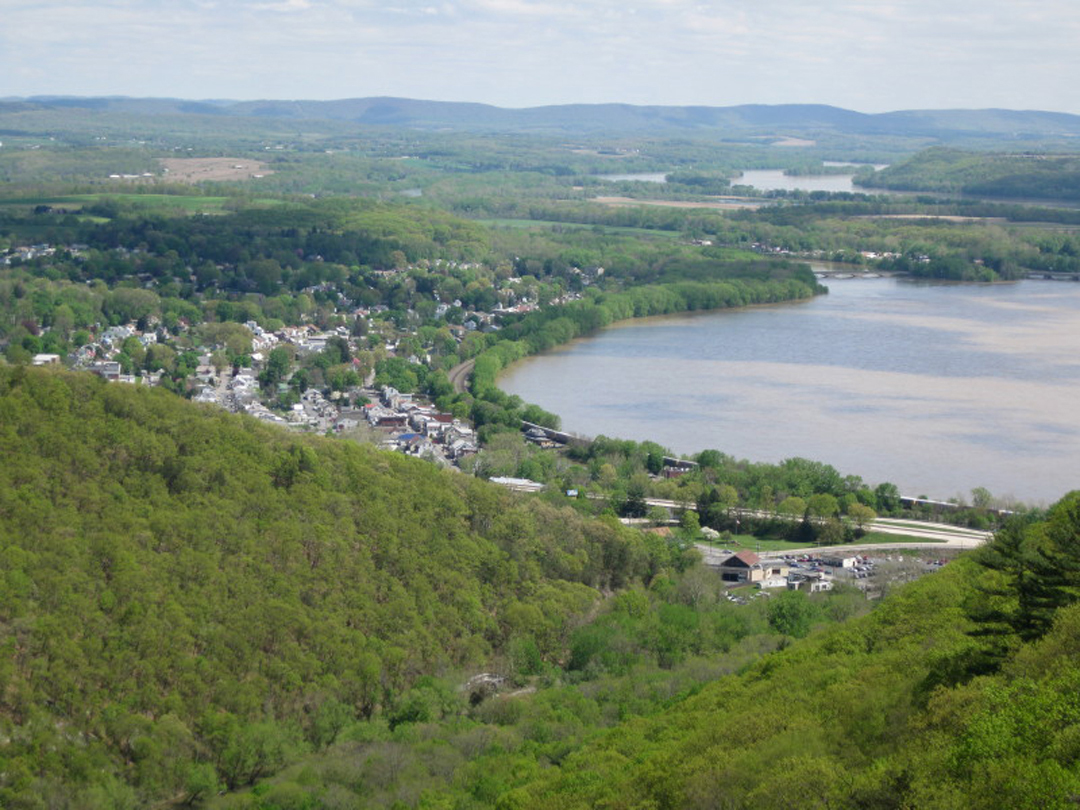
                                                        View of the Town of Pikeville                                                                                                                        


                                                                 The Waterfall

Along the trail you pass a short side path to a lovely spot where the Bad Branch takes a 60-foot plunge over a cliff.  This side trail goes down to a ravine and then climbs steeply through rocks before dropping to the base of the falls 0.9 miles from the branch.  The cascading water makes a soothing sound as it plunges to the rocks below. If you save the falls for the end of the hike the sound of the plunging water on the rocks magically washes away all of the days hard climbs and threatens to ease your mind into a deep relaxing state.


Monday, October 24, 2011

 THE DREAM


     It has always been a dream of mine to hike the Appalachian Trail (AT) through the Great Smokey Mountains National Park (GSMNP).  I don't think there is any better way to prove God's existance than by seeing the beauty of His creation in the mountains and the complexity of all the plants and animals that live there.  The park was established in 1934, and it is believed to contain approximately 400,000 acres.  The Cherokee Indians called the mountains "Shacona-ga" meaning "blue, like smoke."  The smoke is created from a combination of humidity, dense vegetation, and soil type.  Several years ago I stumbled across a hiking group on the internet who had been section hiking portions of the Appalachian trail from start to finish.  This past October I teamed up with them to make my dream hike. The hike was planned to go from the southern end of the GSMNP at Fontana Dam to the northern terminus of the park at Davenport Gap, a total of approximately 70 miles.  We planned the hike to take 7 days. It was a real blessing that this younger group had accepted a slower, half-crippled, much older man to tag along with them. There were five of us making the 70 mile hike, and each one of the other hikers took turns making sure that I made it to camp at the shelters each day. We filled out the necessary hiking group permit, and our leader had reserved space at shelters for each night.                            


      There are very few switch backs along the AT through GSMNP.  Most of the trail goes straight up or straight down the mountains.  Many sections of the trail are lined with very large, loose, angular stones, making it hard for me to walk and causing me to walk much slower than the other four hikers.  The shelters are roofed, three-sided buildings with one wooded platform two feet off the ground and another platform five feet from the ground. Most shelters have roofs made out of semi-transparent plastic to let the light shine through. When it rained the raindrops sounded like a thousand woodpeckers pecking on the plastic.  It rained on separate occasions for two days and three nights.  A water supply, usually in the form of a spring that is sometimes just a trickle, is available at most shelters. I grew up in a log cabin, and many days it was like the "survivor man" meeting the new days challenges.  Hiking long distances with a pack on my back containing everything I own to survive reminds me of those childhood challenges at the cabin.  Food hanging cables are available at each shelter and campground to keep food out of the reach of bears.


     In the following paragraphs you will walk with me as I met each day's challenges along my 7 day AT trek in the GSMNP.  To help you understand the topography, history and geology, I have included some information supplied to me by Appalachian Trail Guide--Tennessee-North Carolina, Thirteenth Edition, V. Collins Chew, Exploring the Appalachian Trail--Hikes in the Southern Appalachians-Georgia, North Carolina, Tennessee, Doris Gove, and Appalachian Trail Names-Origins of Place Names Along the AT-David Edwin Lilliard.  


     Each morning I spent very little time fixing breakfast.  A breakfast cookie or pop tart was sufficient to hold me until I could eat a lunch time power bar.  I managed to get on the trail 20 to 30 minutes before the rest of the hikers.  This time was spent in prayer and thanksgiving to God for allowing me to be able to walk the trail. God reminds me often that I am very fortunate to be able to hike up and down the mountains because there are so many people who have a hard time just to be able to walk.


THE HIKE


DAY 1 - Fontana Dam, N.C. to Birch Spring Gap Approximately 5 miles


     The Fontana Dam was created by flooding the small lumber company town of Fontana.  The dam was built to supply the power for Oak Ridge nuclear plant where fuel was produced for atomic weapons. The hydroelectric lake contains 11,685 acres with a 480 foot tall and 2,365 foot long dam, the highest east of the Rockies.  My hike starts here among an understory of woods of oak, pine, dogwood, and sour wood.  The trail goes up immediately with switch backs among a weedy, rocky ascent along a narrow ridge. At about mile 3.5, I came to a clearing where an old house foundation and a stone chimney is accompanied by the Shuckstack Mountain fire tower. The tower is very dangerous, and anyone who attempts to climb it should be aware that he or she  could fall and become seriously hurt.  The name "Shuckstack" comes from the way the mountain looks "like a standing bundle of corn stalks." Climbing the tower gives rise to a panoramic view of the surrounding mountains and Fontana Lake. The trees were alive with the October fall colors of red, yellow and orange leaves.  The Birch Spring Gap shelter had been previously removed and replaced by tent pads. I camped out and strung my electric bear fence because I had heard that the park was having a black bear problem.  No bears tested the fence that night. In fact, during the whole trip I didn't see one black bear but I did see lots of bear scat.  The bears seemed to be gorging themselves on the red berries from the American mountain ash tree. Because of the threat of heavy rainfall each night I slept in the shelter the entire rest of the trip. 


                                                     Hammock with bear fence


                                                                  Fire Tower


DAY 2 - Birch Spring Gap to Russell Field Shelter Approximately 8 miles


     During this section of the hike I passed over Tater Patch at elevation 4775 feet, Little Abrams Gap at 4,120 feet, and then arrived at Russell Field Shelter.  All of the up and down elevations made me feel like I was on a roller coaster.   Cherokee word Ekaneetlee means "by the river." This gap was the path traveled by the Cherokee to gain access to Cades Cove, an important white settlement.  Later,  the influx of European settlers pushed the Cherokee out of the area and use of the gap. The Russell Field shelter, like all of the shelters on this hike, did not have a privy.  That gave a new meaning to "What do bears do in the woods?"


Day 3 - Russell Field Shelter to the Derrick Field Shelter Approximately 9 miles


     Day 3's  hike crosses over Rocky Top at elevation 5,441 feet, Thunderhead-East Peak at elevation 5,527 feet, Mineral Gap at elevation 5,030 feet, Sugar Tree Gap at elevation 4,435 feet, arriving at Derrick Knob Shelter.  This area is heavy in rhododendron growth which obstructs the view of the thunderhead shaped rocks of Thunderhead Mountain.  Derrick Field Shelter is in the spot where a herder's cabin once stood.  European wild hogs, having escaped from hunters, invaded the Smokies from the south where they live today with no predators and  plenty of wildflower roots to eat.  Because of this, the hogs continue to forage areas along the trail.


Day 4 - Derrick Field Shelter to the Mt. Collins Shelter Approximately 14 miles


     Some of the highlights of this hike are the crossing of Buckeye Gap at elevation of 4,817 feet, Silers Bald, Clingmans Dome at elevation of 6,643 feet and Mt. Love.  Buckeye Gap was named by the settlers because of the abundance of very large buckeye trees with their big yellow leaves. Silers Bald was named after Jesse Siler who grazed cattle here in the mid-19th century. Clingmans Dome is the highest point on the Appalachian Trail.  There is an observation tower on top of Clingmans Dome where people from all over the world come to view the surrounding mountains.  At this time it was especially attractive because the leaves had changed colors.  The descent from Clingmans Dome was very steep with lots of large, loose, angular boulders that took a toll on my already tired and bruised knees. The trail here runs along hardwoods as well as conifers. The fresh smell of the evergreens reminded me of the smells of Christmas. When I was a teenager I helped my dad sell freshly cut evergreens for the local Lions Club Christmas tree sale. There are many beautiful views of the valleys below nestled by low lying clouds, hence the name Smokey Mountains.


Day 5 - Mt. Collins Shelter to the Icewater Springs Shelter Approximately 8 miles


     The trail crossed Indian Gap, Newfound Gap,  arriving at Icewater Springs Shelter.  Indian Gap was believed by the Indians to be the lowest pass across the Rockies.  Newfound Gap is the lowest roadway (US 441/NC 71) crossing of the state line between North Carolina and Tennessee. The roadway gap connects Gatlinburg Tennessee with Cherokee, North Carolina.  This is the only roadway crossing of the Smokey Mountains.  Friends from the Trail Dames met us with a treat of submarine sandwiches, chips and a fabulous Oreo dessert.  It was cold and windy, and I came close to hypothermia from being wet and cold.  I shivered as I ate.  Once I began hiking again, it didn't take long to warm up.  No matter how rainy it was, I always tried to save some dry clothes to sleep in. I put the damp clothes in my sleeping bag, and they were dry by morning. I think they could have named all of the shelters "icewater" because the water at each shelter comes straight  from a well spring beneath the surface. Yellow birches and spruce tree line the narrow AT as it crosses through fractured shale outcropping. The mountainous views are only bested by day 6's hike.


Day 6 - Icewater Shelter to the Tri-Corner Knob Shelter Approximately 13 miles


     This day"s hike was the most beautiful one I have ever taken.  The hike crosses Charlies Bunion, The Sawteeth, Bradleys View, Mt. Sequoyah, Mt. Chapman and arrives at the Tri-Corner Knob Shelter.  After the climb from Newfound Gap the trail becomes a series of ascents and descents with views of Mt. Le Conte and Charlies Bunion.  The clouds that day filled the valleys.  Charlies Bunion becomes a rocky ledge, named by Horace Kephart in honor of the sore foot of Charlie Conner, a man who inspected storm damage.  The rock is Anakeesta Formation slate, giving a red color from iron oxidation.  This rock is less stable than the sandstones of Clingmans Done.  Because of the irregularities of these rocks, lichens and mosses colonize some cracks, and low growing shrubs like mountain laurel and sand myrtle try to become established. Small short flowers try to get a foot hold against the windy slope. Breathtaking views are seen on both sides of the slope. We can only imagine what a view birds must have flying over this area. My wish was that I could trade places with the large black bird that was flying over my head. After Charlies  Bunion, the trail passes through spruce trees and enters a south facing grassy hillside with blackberries and honeysuckles.  As the trail continues, it passes through patches of beech trees with a smattering of evergreens.  The trail passes through dotted rock croppings lined with different colored lichens and mosses in rock fractures.  These are organisms that begin the long erosive process of wearing away the mountains.  The rocky Sawteeth outcroppings are due to the jagged sections of the Anakeesta formations. The narrow ridge trail allowed me to see the deep valleys on both sides of the ridge as it straddles the state line of North Carolina and Tennessee.  I sat on a rock where I could put one foot on each side of the rock and in each state. As I neared the path to the shelter, the AT swung through a large area of fallen trees, created by the recent hurricane that blew through this area.  I passed over Mt. Sequoyah, named for a Cherokee silversmith who developed written Cherokee language by analyzing the sounds and assigning symbols to them.  Sandstone replaces the slate near the shelter.  The trail continued to rise and fall until I reached the shelter, near 6,000 feet of elevation.


Day 7 - Tri-Corner Shelter to Davenport Gap ( Ranger Station) Approximately 14 miles


     A large portion of this trail is shared with horses--a blessing and a curse. Because horses share the trail it is more gradual with accents and descents to Davenport Gap.  The last five miles of this section are covered with small fractured shale, a real nightmare for people with weak knees or ankles.  I had to go very slowly, trying not to turn an ankle or twist a knee. My fellow hikers were super by checking on me often to make sure I was still moving down the trail. There were Appalachian Trail Conservancy trail maintenance personnel working on the trail along this section.  New species of hardwoods were seen along the trail including species of pawpaws, oaks, beeches, and birch trees. I heard many small birds, usually seen at these lower elevations.  


Who may ascend the hill of the Lord? Who May stand in His holy place? He who has clean hands and a pure heart, who does not lift up his soul to an idol or swear by what is false.
                                                                 Psalm 24:3-4


Thursday, August 4, 2011

Light weight Hiking Stoves

Backpacking Stoves


I want to discuss light weight solo backpacking stoves that I carry on long hikes. When I go backpacking I try to carry the least amount of weight I can. Many hikers don't mind carrying 50+ pounds on a long hike of 7 days or more. Most people can carry a lot of weight 50 + pounds for over night or weekend hikes. I try to lighten my pack weight every time I hike.

Gas Canister Stoves


Gas canister stoves are heavy and require fuel tanks to burn, They are very good for group hiking but not for solo hikers. A liter of water will boil in a little over a few minutes. Depending on the number of hot meals eaten a day, you can boil about 8 liters per canister.

Alcohol Stoves


Alcohol stoves are very light weight but requires alcohol to burn which makes it heavier. They are very inexpensive and you can make them out of soda cans. Boil time maybe around 6 minutes. You have to carry about 2 to 4 ounces of fuel per day, around 14 to 28 ounces for a week. You must keep the fuel from spilling in your pack.


Wood Burning/Esbit Stoves


The lightest of all stoves. Boil time of one liter is around 10 minutes. Most wood burning stoves can burn solid fuel (esbit) or alcohol. I carry the Bushbuddy Ultra Wood Stove or the Four Dog Bushcooker LT Stove. The Bushbuddy is thin steel (144.6 grams - 5.1 ounces ) and the Bushcooker (58.4 grams - 2.58 ounces ) is titanium. You can almost always find wood to burn and you may carry a few solid fuel esbits if the wood is wet, each esbit block is 12 grams. For me these two stoves are my best options because of their light weight. No waste is created and you don't have to carry any empty containers back home.


Bushbuddy Stove


With 600 ml Pot


Four Dog Bushcooker


Bushcooker With 600 ml Pot

Disadvantages 

Burning wood or solid fuel leaves soot on the bottom of the pot. You will have to wipe or wash it off before packing it. You will have a longer boil time and after a hard day of hiking you may not want to wait that long. These stoves are mainly for solo hikers. You must carry a few solid fuel pellets (esbits) in case you have rain.

Below is a picture of some of the fire starters and fuels I take along with me on a hike.


Waterproof matches, lighter (also comes in a half size), fire stick, waterproof container for matches, hand sanitizer (sometimes used with cotton balls and a solid fuel pellet (esbit).


I often use clothes dryer lint as well as fire starter sticks to start my fires.

Let me know of some of your favorite backpacking stoves and fire starters you use.


Sunday, June 26, 2011

"X" Factor

Hiking/Backpacking "X" Factor

The theme that runs through all of my pod casts is light weight hiking.  Several of my friends have tried hiking/backpacking with little success.  I will tell you more about how one of these hikes turned out later.  I developed a way I evaluate a friends ability to successfully complete a hike before we ever consider hiking.  This means of evaluation was developed solely on the observation of hikers by me during my 20+ years of trail hiking. The process is not based on any medical research and I used it only as an estimate of ones possible ability to complete one of my hikes. I excluded friends with medical conditions (example: high blood pressure, heart condition, etc,). I made sure that they had had a physical exam by a doctor and was determined in good enough condition to hike safely. The "X" Factor is a number that indicates how much more effort a hiker "friend" may have to expend to hike the same distance as an average hiker. I have taken into consideration the weight of the pack, the weight of the person,  age and physical condition. A person who is 40 years of age, in good physical condition, at their optimum body weight carrying a 30 pounds pack should be able to complete a 10 to 25 mile hike in one day without much effort. No effort was given to distance or speed of the hiker in this evaluation.

Score Points

The object of the evaluation is to add all "X" Factor points together while trying to get as close to zero as you possibly can. A hiker friend who scores a total of zero should be able to complete one of my distance hikes.

Age

 10          20         30      40        50        60        70       80     Years

 -3            -2          -1        0         +1      +2         +3       +4     Points


Physical Condition

Excellent         Good            Fair             Poor       Condition

  -1                     0                +1                 +2        Points


Pack Weight in Pounds


     10                    20                   30              40            50      Pounds

      -2                     -1                    0              +1             +2     Points


Hikers Weight  in Pounds Over/under Optimum Weight

     -10            -5               0                 +5               +10           +20    Pounds
  
       -2            -1               0                 +1               +2             +3      Points

A hiker who is 30 years old in good condition carrying a 40 pound pack and is 10 pounds over weight would have an "X" Factor of +2. This means this hiker would have to exert twice the effort to complete a 25 mile hike in one day.

My Experience Before I Developed the "X" Factor evaluation

I have a friend I asked to go on a hike with me. He assured me that he was in good enough condition to hike and that he had just retired from the military and was used to taking 10 mile hikes with a full pack.  I planned a 3 day 2 night 30 mile hike. He was 55 years old in fair physical condition about 10 pounds over weight and carried a 50 pound pack. We hiked 9 miles the first day and he was too tired to finish the second days hike. The hike was too strenuous for him to complete.

If I had evaluated him using the "X" Factor method I would not had asked him to go on the hike. His fair physical condition scored him a +1, 55 years old scored a +1, 50 pound pack a +2 and being over weight by 10 pounds a +2. His overall score was a +6. That meant he would have to exert an effort of 5 times greater than an average hiker. In order for him to exert the same effort as an average hiker he would have to lose 10 pounds of body weight, drop 30 pounds pack weight and get in good shape before taking another hike. He never hiked again!

For an older person the weight of the pack is one of the most critical factors that a hiker can change. You can without too much effort reduce your base pack weight by at least 30 pounds and you will use less effort to complete a distance hike. That is why it is so important to go ultra light.

The above evaluation was used by me to help determine the amount of effort my friends would have to expend while hiking with me on a backpacking trip. It is not meant to be used by anyone else but only as information on how I evaluated hiker friends.

Psalm 61:2 - From the ends of the earth I call to you, I call as my heart grows faint; lead me to the rock that is higher than I.


Wednesday, May 25, 2011

Hiking the Appalachian Trail in Pennsylvania

 The Plan

Everyone needs a plan when attempting any hike. My plan was to hike from Caledonia State Park in Pennsylvania to the town of Duncannon on the Susquehanna River in Pennsylvania a total of 65 miles. I arranged to  meet two other hikers from Raleigh North Carolina and Virginia to be my companions. They hiked at a faster pace and soon left me after the first 15 minutes of every day. I usually hike at about a 2 mile per hour pace and stop to take take pictures on an occasion. They stopped and waited for me to catch up several times along each days hike. We had agreed that if I didn't show up at camp after several hours that they would come looking for me.

I have hiked a lot in my lifetime but I have been seriously hiking for about 5 years and find that every hike is different. Each trip becomes a learning experience. I am always testing out new gear and try to carry as little weight as possible. I was scheduled for a double knee replacement about 10 years ago but decided to just hike and bicycle till my knees wouldn't bend anymore. On this hike my challenge was to see if I could cut my daily food requirement  by half. Most experienced hiker/backpackers recommend to carry about 2 pounds of food per day. In my last blog I showed how I could cut the food weight to one pound per day.

The Hike

This 65 mile backpack of the AT traveled through areas rich in the history of the iron industry. Iron furnaces and blacksmith shoppes supported the towns along the route.


                                There were many unique areas along the trail like this "egg tree."

Along one part of the hike Hessian troops in the 1700's, escaped slaves in the 1800's and Nazi submarine commanders all passed along large bands of quartzite boulders laced with stripes of white quartz. Camp Michaux runs along the edge of the trail where WWII prisoners of war were kept. Large iron furnaces are found all along the trail.


Iron Furnace

Communities of workers lived and worked around the iron furnaces. Many of the buildings have been renovated and are used as hostels. We stayed in the old pay masters house where at the end of a pay period the workers would be paid.


Pay Masters House - Workers would go up one set of stairs, get paid and then go down the other set of stairs.

Not far along the trail we passed the midpoint of the entire Appalachian Trail at 1090.5 miles from Georgia to Maine.


It rained for several hours while hiking along the trail. The water flowed along the trail like a small stream. We had to hike in ankle deep water to stay on the trail and through muddy fields.


Trail Stream


Water Trail


Muddy Field


There were many modern well kept shelters along the trail


Shelter


As well as many modern bathroon facilities.


Modern Outhouse "Privy"

The trail is a roller coaster type hike up and down along the northern end with many rocky formations. The trail crosses through the town of Boiling Springs an iron industry settlement around a large lake.


Town of Boiling Springs

This 65 mile hike ends in the Town of Duncannon along the Susquehanna River.  Despite the rainy weather, and the muddy wet trail I enjoyed the fellowship of two very nice men that made backpacking this section of Pennsylvania a real treat.


Town of Duncannon

Psalms 3:4
To the Lord I cry aloud, and he answers me from his holy hill. 


Monday, May 2, 2011

Food Carried on a Five Day Hike by Weight


I recently completed a five day hike on the Appalachian Trail in Pennsylvania. I decided to weigh each food item that was taken on the hike in grams. I weighed the food in grams because I could get a more accurate measurement for each item.
Many hikers carry 50 pounds and up in their packs and have no problem doing it. This post is for those who need to carry less weight in their packs. Most hiking books state that hikers carry on an average of  2 pounds of food per day. Two pounds is equal to  907.18 grams.

Lets First Look at Tuesday the first day of the hike.

Breakfast is not included because the hike started after the meal.


Chili Mac Dinner                          82g
Cliff Bar   Lunch                           48g
Cliff Shot Extra Energy                 34g
Mars Bar   After Dinner Snack      54g
Crystal Light Dinner Drink            04g
Mixed Nuts  Lunch                        44g
Nutrient Drink Evening drink        32g
Plastic Bag                                     08g

Total                                            306g

Second Day Wednesday Full Day


Chili Mac Dinner                          84g
Oatmeal Packet  Breakfast            36g
4 Packs Raw Sugar  for Coffee     20g
Honey 2 Packs  for Oatmeal          22g
Creamer                                         04g
Coffee Bag                                    06g
Breakfast Cookie                           50g
Mixed Nuts Lunch                         48g
Crystal Light                                  04g
Cliff Shot                                       34g
Cup of Soup Packet                       16g
Power Bar Lunch                           68g
Mars Bar                                         52g
Nutrient Powder                             36g
Bag                                                 10g

Total                                             490g

Thursday Hike


Mac and Cheese                           104g
Pop Tarts Bag                               106g
Mars Bar                                         52g
Power Bar                                       70g
Creamer                                           02g
Mixed  Nuts                                    44g
4 Packs Raw Sugar                         20g
Cliff Shot                                         32g
Soup Packet                                     16g
Breakfast Cookie                             48g
Nutrient Powder                              32g
Tea Bag                                           02g
White Sugar packet                         06g
Crystal Light                                   04g
Coffee Bag                                      04g
Plastic Bag                                      10g

Total                                             552g


Friday Hike


Beef Trekkie                                     94g
Mars Bar                                             50g
Cliff Shot                                            32g
Oatmeal                                              46g
Big 100 Bar                                      104g
Coffee Bag                                         04g
4 Pack Raw Sugar                             20g
Crystal Light                                      04g
Creamer                                             04g
White Sugar 2 Pack                           06g
4 Packs Honey                                  38g
Mixed Nuts Packet                            46g
Tea Bag                                             02g
Nutrient Drink                                   30g
Plastic Bag                                        10g

Total                                                  490g


Saturday Hike Evening Meal is Not Included


Pop Tarts                                          110g
Cliff Bar                                             70g
Mars Bar                                            50g
Mixed Nuts                                        46g
Coffee Bag                                        04g
Nutrient Powder                                32g
Crystal Light                                     04g
Creamer                                            04g
4 Pack Raw Sugar                            16g
Cliff Shot                                          32g
Bag                                                   10g

Total                                                  378

The grand total of food I carried for all five days was 2,216 grams converted to 4.89 pounds. This is just about one pound per day.

So if you want to pack ultralight you do not have to pack on an average of 2 pounds of food per day. Of course this does not include water nor the food bag to carry the food.

Thursday, February 24, 2011

Winter Hike

 The Trails are Calling


I have been like the black bears in the Blue Ridge Mountains of Virginia in hibernation coming out for the first time this year. I took my first hike of the year in February of this year. It was along one of my favorite hikes a 8 mile plus hike of Doyles' and Joneses Run. I love the views of the small waterfalls along both streams. I also wanted to try out an ultralight pack I ordered from Ultralight Backpacking. I am always in the hunt for light weight backpacking equipment. I was diagnosed with a loss of all of my cartilage in my knees about 15 years ago after many years of marathon and ultramarathon running.  The doctors said I needed two knee replacements and I would not run or hike again. After three doctors opinions I decided to take glucosamine and chrondroitin and forget the doctors advise. I may not be the fastest hiker but I am still hiking the trails. I grew up in the country and I feel like I must return to it to be complete. The Doyles' and Joneses Run hike was perfect to start my season.


Waterfalls 


Therapy


In Virginia we look for the black bear to come out of hibernation in the month of February. I love to hike the trails looking for the signs of bear activity. I usually find bear tracks and scat along the trail.   


While taking pictures of the waterfalls along the trail I was almost hit by falling sheets of ice.


When I hike in the mountains I am reminded of the scripture Isaiah 49:13 - Sing, O heavens; and be joyful, O earth; and break forth into singing, O mountains: for the Lord hath comforted his people, and will have mercy upon his afflicted.