Part 1
Preparation
It takes a lot of preparation and prayer to plan for a backpacking hike across the Grand Canyon. There are two times a year that the Grand Canyon National Park service will permit campers to hike the Grand Canyon rim to rim. Most of the camping facilities are open in the spring and the fall. May and September are the permitable months of the year. Two friends and I decided to try for the May hiking window. We could choose any days from mid-May through the first week in June. We decided on the four days from May 23 to May 26 but left it open for any four days in the permitable season. I applied on the first day of January for the May hike. We finally were granted a permit to camp May 26 through May 29. There are no permits required for day hikes. You may make any day hikes you wish, but you must complete the hike in one day. Many people trail run the entire 25 miles from rim to rim in one day, and a few even run the trail rim to rim to rim in one day. We could have hiked the trail in three days, but we stayed an extra day at Phantom Ranch to do a few day hikes. One of our other hiking friends advised us to do it that way.
The Plan Summary
We flew from the east coast to Phoenix, stayed the night, rented a car, and drove to the Grand Canyon the next day. We then drove to the south rim and spent the night. The next day we took the shuttle to the north rim and spent the night at the North Rim Campground. The next morning we got an early start at 5 AM. We hiked to the Cottonwood Campground, approximately 7 miles, and stayed the night. The next morning we began again at 5 AM and hiked 7 miles to Bright Angel Campground,. We spent an extra day at the Bright Angel Campground. The fourth day we hike 5 miles to Indian Garden Campground an oasis half way up to the south rim. The last morning I left camp at 4 AM because the previous day's temperature was 119 degrees, and I wanted to reach the south rim before it got too hot. This was a 5 mile hike. That day we showered, changed into travel clothes, and returned the rental car to fly back home.
Detailed Trip
The flight to Phoenix was uneventful except the metal zippers in my convertible hiking pants set off the metal detectors, and I had to be searched. I checked my suitcase at the ticket counter. My theory was to put my empty pack into my suitcase and load everything else on top of it. That way if the suitcase was searched they could put everything back into the suitcase without much disruption. The plan worked great. When I got to the south rim campground I repacked the backpack and left the suitcase in the rental car. The shuttle the next day cost $85 per person and took about four hours to reach the north rim campground.
South Rim Mather Campground
North Rim Shuttle
The north rim shuttle carried around nine passengers. Of the nine passengers only the three of us were hiking rim-2-rim. The other passengers were running the trail in one day. They planned to start at 4 AM the next day and finish at 4 PM the same day.
Some people take the mule ride to the bottom of the canyon. The riding mules are kept apart from the pack mules by cutting their tails differently. The riding mules have a staggered cut tail and are trained for a much different ride than the pack mules.
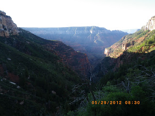
After spending the night at the North Rim Campground my two hiking friends and I started at 5 AM the rim-2-rim hike on the North Kaibab Trail, which is around 8,000 feet .
The trail was about two to three feet wide and about two inches of deep dust. It was easy hiking and the dust cushioned my knees. Photo taken by an unnamed hiking companion.
We traveled through the Supai Rock Tunnel and saw the Roaring Springs gushing from the side of the canyon high above on the wall of rock.
The first night we stayed at the Cottonwood Campground about 7 miles down the trail. We were amused half the day by lots of 3 to 5 inch long lizards puffing out their colorful necks and doing more push ups than Rocky could ever think about doing. Much of the trail from this point on is paralleled by Bright Angel Creek.
The next day after a short hike we took a detour to Ribbon Falls about 3,720 feet in elevation. This day's hike was 7 miles long, ending at the Bright Angel Campground near the Phantom Ranch at 2,490 feet in elevation.
This a picture of the pack mules at the Phantom Ranch. All supplies had to be packed into the ranch and Bright Angel Campground. The ranch canteen had the best ice cold lemonade and served a great beef stew. This photo was take by Hezekiah Goodson, Jr.
This is Bright Angel Campground. A T-shaped pole in the background was a futile effort to stop ground squirrels from getting into our packs. Ammunition boxes were provided at each camp site to protect our food from wild animals. Photo was taken by an unnamed hiking companion.
The next part of the journey will be on my next blog Part 2.


