Saturday, July 14, 2012

Grand Canyon Rim-2-Rim Backpacking Arizona
                            Part 1

Preparation

It takes a lot of preparation and prayer to plan for a backpacking hike across the Grand Canyon. There are two times a year that the Grand Canyon National Park service will permit campers to hike the Grand Canyon rim to rim. Most of the camping facilities are open in the spring and the fall. May and September are the permitable months of the year. Two friends and I decided to try for the May hiking window. We could choose any days from mid-May through the first week in June. We decided on the four days from May 23 to May 26 but left it open for any four days in the permitable season. I applied on the first day of January for the May hike.  We finally were granted a permit to camp May 26 through May 29. There are no permits required for day hikes. You may make any day hikes you wish, but you must complete the hike in one day. Many people trail run the entire 25 miles from rim to rim in one day, and a few even run the trail rim to rim to rim in one day. We could have hiked the trail in three days, but we stayed an extra day at Phantom Ranch to do a few day hikes. One of our other hiking friends advised us to do it that way. 

The Plan Summary

We flew from the east coast to Phoenix, stayed the night, rented a car, and drove to the Grand Canyon the next day. We then drove to the south rim and spent the night.  The next day we took the shuttle to   the north rim and spent the night at the North Rim Campground. The next morning we got an early start at  5 AM. We hiked to the Cottonwood Campground, approximately 7 miles, and stayed the night. The next morning we began again at 5 AM and hiked 7 miles to Bright Angel Campground,. We spent an extra day at the Bright Angel Campground. The fourth day we hike 5 miles to  Indian Garden Campground an oasis half way up to the south rim. The last morning I left camp at 4 AM because the previous day's temperature was 119 degrees, and I wanted to reach the south rim before it got too hot.  This was a 5 mile hike. That day we showered, changed into travel clothes, and returned the rental car to fly back home.

Detailed Trip


The flight to Phoenix was uneventful except the metal zippers in my convertible hiking pants set off the metal detectors, and I had to be searched. I checked my suitcase at the ticket counter. My theory was to put my empty pack into my suitcase and load everything else on top of it. That way if the suitcase was searched they could put everything back into the suitcase without much disruption. The plan worked great.  When I got to the south rim campground I repacked the backpack and left the suitcase in the rental car. The shuttle the next day cost $85 per person and took about four hours to reach the north rim campground. 


                                                        South Rim Mather Campground


                                                        North Rim Shuttle


The north rim shuttle carried around nine passengers.  Of the nine passengers only the three of us were hiking rim-2-rim. The other passengers were running the trail in one day. They planned to start at 4 AM the next day and  finish at 4 PM the same day.


Some people take the mule ride to the bottom of the canyon. The riding mules are kept apart from the pack mules by cutting their tails differently. The riding mules have a staggered cut tail and are trained for a much different ride than the pack mules.


After spending the night at the North Rim Campground my two hiking friends and I started at 5 AM the rim-2-rim hike on the North Kaibab Trail, which is around 8,000 feet .


The trail was about two to three feet wide and about two inches of deep dust. It was easy hiking and the dust cushioned my knees. Photo taken by an unnamed hiking companion.


We traveled through the Supai Rock Tunnel and saw the Roaring Springs gushing from the side of the canyon high above on the wall of rock.


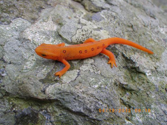
The first night we stayed at the Cottonwood Campground about 7 miles down the trail. We were amused half the day by lots of 3 to 5 inch long lizards puffing out their colorful necks and doing more push ups than Rocky could ever think about doing. Much of the trail from this point on is paralleled by Bright Angel Creek. 


The next day after a short hike we took a detour to Ribbon Falls about 3,720 feet in elevation. This day's hike was 7 miles long, ending at the Bright Angel Campground near the Phantom Ranch at 2,490 feet in elevation. 


Before we could reach the Phantom Ranch and Bright Angel Campground we had to go through The Box. The Box is part of the Bright Angel Canyon--a very hot part of the trail, and we had to get through it before the hottest part of the day from noon to sundown.


This a picture of the pack mules at the Phantom Ranch. All supplies had to be packed into the ranch and Bright Angel Campground. The ranch canteen had the best ice cold lemonade and served a great beef stew. This photo was take by Hezekiah Goodson, Jr.


This is Bright Angel Campground. A T-shaped pole in the background was a futile effort to stop ground squirrels from getting into our packs. Ammunition boxes were provided at each camp site to protect our food from wild animals. Photo was taken by an unnamed hiking companion.

The next part of the journey will be on my next blog Part 2.

Thursday, May 3, 2012

An Overnight Hike on the Appalachian Trail Near Waynesboro, Virginia

A Small Look Into The Window of Creation


Backpacking has always been a love of my life ever since I was born. I was born a second generation Polish American in the northern part of Virginia.  I grew up in an old converted log cabin with very few modern conveniences. We had an outside spring for our water source and an old shaky privy for a bathroom. The outdoors was my play area. This may sound like I lived in any shelter along the Appalachian Trail but I didn't know I was any different until I started attending public school. That is why I love to backpack because I can still relate to  life the way it was when I was growing up. I feel almost insulted when someone tries to tell me that all of the living and nonliving things around me were created by mistake or by natural selection. There can be only one way that all of the beautiful plants, animals, and geologic features were created and that is by God.

A Short  Hike

One Thursday a friend and I decided to take a short five mile hike to a shelter, camp out, and hike back the next day. It had rained the day before enough to encourage many flowers to bloom the next day. Many red, pink and white flowers gave me an extra lift and a quick to my steps. The air was crystal clear and I knew in a moment that we were in for a pleasant two days on the trail. We passed many hikers along the trail and many of them were hiking long distances and a few could be considered thru hikers. We are both hammock backpackers and after hanging our food on the bear pole  it only took minutes to erect our shelter. The temperature that night dropped near 40 degrees testing our skills on keeping warm. we enjoyed the hike and looked forward to hiking again soon. I am trying to get into shape for my rim-to-rim hike of the Grand Canyon at the end of May.


Fire Pink 


Wild Geranium


Rue Anemone


Salamander


AT Shelter


Pack Hanger


Stream Near Shelter


Hennessey Zipper Hammock


Camp Privy


Haunted Cabin Remains

"Very early in the morning, while it was still dark, Jesus got up,  left the house and went to a solitary place, where He prayed." Mark 1:35


Friday, February 17, 2012

Stripped Bass Revisited


Me and My Fish


When I was a small boy I loved to study the life and habits of fish. I graduated from college with a BS in Biology and later a MS in Environmental Sciences and obtained a successful career in environmental engineering and marine biology. My masters thesis centered on the age and growth of the stripped bass Morone saxatilis in and around the James River and Chesapeake Bay.  About a dozen of the members of Grove Avenue Baptist Church every year go stripped bass fishing around the mouth of the Chesapeake Bay. This year on February 10, 2012 I had the privilege to attend this fishing trip. It was like going to see some distant fish relative  I had not seen for years. Once again I would have the chance to be reunited with my stripped friends from days past. Due to the Chesapeake Bay Conservation Act we would be allowed to keep two fish each for food. Stripped bass in the Bay are called rock fish.  Before I go into the details of my fishing trip experience let me tell you a few facts about stripped bass.


Fish Lesson


Stripped bass are anadramous fish living in saltwater and going up freshwater rivers to spawn or lay eggs.  A 50 pound female may lay up to 5,000,000 eggs in one spawn. The most important variable in determining when the fish spawn is water temperature. The best temperature for fish to migrate is between 57 to 71 degrees. This fact will help you understand my fishing experience later. After the eggs hatch the young fish return to the saltwater for two years to grow. The stripped bass makes two migrations in the spring and the fall to return up the freshwater rivers to spawn. They are usually 30 inches in length for the first migration. At this time they have a ferocious appetite and will eat just about anything in their path but prefer other fin fish. December and January are good months to fish for the strippers as they swim upstream in the rivers. The adults may live for up to forty years and reach a weight of 100 pounds. But the norm is about 10 years old for males and 20 years old for females. An average female may lay 850,000 eggs with each spawn.  On an average a 15 inch fish may weigh 2-3 pounds and be 2-3 years old, a 30 inch fish may weigh 11-16 pounds and be 8-14 years old, and a 45 inch fish may weigh 30-45 pounds and be 15-30 years old. You can determine the age of these fish by looking at the rings on a fish scale like the annual rings on a tree. When I was doing my research on the stripped bass I aged about 10 thousand fish in and near the mouth of the James River. I usually took 4 to 5 scale samples per fish. That is a lot of looking at scales under the microscope. I became very familiar with my new friends. 


How do we determine where the best fishing spots are going to be to catch the biggest and best fish?  I have been told that you are only allowed to keep two stripped bass on each trip and there is only a catch and release requirement within the Chesapeake Bay boundaries.  Your best bet is to fish during the two upstream spawning migrating of spring and fall. Stripped bass tend to be in shallower waters at this time. The warmer the water the deeper they will go. The best time might be in December, January, or February. Look for feeding birds circling on top of the water marking a spot where birds are eating fish scraps left from the hardy appetite of the stripped bass. Fish during the first 3 hours of an outgoing tide or the last 3 hours of an incoming tide. Look for the turbulent water indicating that there are large masses of fish movement below the surface. The strippers feed the best in a temperature range of 40 to 75 degrees. If all else fails have your caption of the boat turn on his fish finder to spot the fish movements.


Fish Story


Back to my fish story. I was thrilled to be able to be with a bunch of Christians on a boat fishing for my "days gone by" friends of the past stripped bass. Two church friends picked me up about 4:15 AM to travel to a Virginia Beach for a 7 AM boat launch. We traveled in the boat north to the mouth of the Chesapeake Bay. The air temperature was around 25 degrees. It was a large fishing boat with a closed in cabin to warm up in when we got cold on deck. When we reached the spot the boat made a continuous circle with the fishing lines trolling behind. We used lures because these fish are so hungry that they will bite at anything that looks similar to a fish. We trolled at several spots for several hours without any luck catching fish. We gave up on catching and keeping the fish to eat and decided to go into the Bay to catch and release fish to get the thrill of catching a big fish. Again with no luck. By this time it was getting late and we decided to call it quits and headed home. On the way back to the dock the motor in the boat quit. The captain had to radio for a tow back to the dock. We got back to the dock no worst for ware. Some of our party stopped off at a seafood restaurant to be able to at least eat some stripped bass even though they could not catch any fish.


Why didn't we catch any fish?


We went fishing in February toward the end of the fish migrations at the time when the weather has been unseasonably warm. Spawning fish like to travel in cooler temperatures. The fish sensing warmer weather approaching moved faster up the rivers to spawn leaving fewer in the coastal areas to catch. The group usually books the fishing boat well ahead of time in order to reserve it during the fish spawning times. Like all fishing trips there is no guarantee that you are going to catch fish. The group leader said that he has been doing this for ten years and this is the first time he has never caught any fish. If I am invited back next year I want to prove that I was not the unlucky banana (bananas were consider unlucky to take with you on a fishing trip).


I enjoyed the fellowship of christian men and women on this fishing trip and would do it again in a heart beat.


Isaiah 19:8 The fishers shall mourn, and all they that cast angle into the brooks shall lament, and they that spread nets upon the waters shall languish.


Thursday, January 19, 2012

Two Short Hikes

Day hikes can be very rewarding during the winter. I just completed two hikes of five miles each. What a better way to start a new year than to take a nice quiet walk in the woods and also what a better way to start getting into shape than to begin hiking during the coldest day of the year. I did just that by taking a five mile hike around the Wintergreen ski resort on new years eve and a five mile circuit hike in January during 22 degree temperature and a 0 degree chill factor. Let me share these hikes with you:


Wintergreen New Year Eves Hike


I was treated to a stay in a condo at the Wintergreen resort ski resort.  Several slopes were open but I preferred to hike on the trails around the resort. Virginia has had an exceptionally warm winter this year with very few snow falls and a mild weather. The ski slopes that were open were maintained with man made snow. I had purchased a new GoPro movie camera and I was eager to try it out.


                      The resort perimeter hiking trail crossed several streams with waterfalls.


Video of the hiking trail waterfall at Wintergreen Ski Resort
                                                                                                

Humpback Mountain Cool  Hike

I like to start each years hiking in January. The winter weather becomes a real challenge with freezing temperatures and lots of precipitation. I can usually be on a hiking trail in an hour and a half from my home. The Blueridge Mountains are almost in my back yard with lots of circuit hikes as well as the Appalachian Trail (AT). Sometimes I begin the season with an 8 mile loop of  the Humpback Rocks and the AT trails. I began the hike at 7:30 AM and the temperature was 22 degrees where the car was parked at the base to Humpback Mountain. The wind was so strong that as soon as I opened the door it blew everything that was loose in the car into the woods. I estimated the chill factor to be around  0 degrees. I was prepared for the cold temperatures. I wore hiking boots with a synthetic sock and a wicking wool blended sock on top. I had hiking pants with short gaiters to keep the wind out. A long sleeve synthetic shirt with a down vest was topped off with a hooded wind breaker. A polartec Mountain Hardware over the ears hat and gloves completed my hiking clothes. It snowed off and on during the hike but I never got cold and I wish that I could have hike longer. It was a very enjoyable hike.


On top of Humpback Rocks


A hike to the top of Humpback Rocks.

Direct my footsteps according to your word; let no sin rule over me. Psalm 110:133


Saturday, October 29, 2011

Bad Branch Falls State Nature Preserve

The Bad Branch Kentucky Nature State  Preserve

The preserve is 2,343 acres that includes Bad Branch Gorge, the Presley House Branch watershed. the upper reaches of the Bad Branch watershed and a small portion of the north face of Pine Mountain. The preserve contains large concentrations of about 30 species of rare and uncommon flora and fauna as well  Kentucky's only known nesting pair of common ravens. A few of the rare species are enchanter's nightshade, Fraser's sedge, painted trillium, and the long tail shrew.  Black bears frequent this area. Bad Branch is classified as a Kentucky Wild River.Bad Branch flows down the south side of Pine Mountain through hemlocks and rhododendron-lined banks emptying into the Poor Fork of the Cumberland River. The area was logged in 1940 but a few old growth hemlocks were spared and thrive above the ssecond growth trees.  Several old roadways are found through the area.  Old rusted automobile remains may be seen along the old roadway.  Large boulders can be seen all along the the mountain slopes. On the top of Pine Mountain is a big sandstone slab known as High Rock. From the top of  High Rock you can see the Town of Whitesburg and the valley cut by the North Fork of the Kentucky River. A 60 foot waterfall is created by a  plunge of water of Bad Branch over a sandstone cliff.

                                                   Bad Branch Hike

Early travelers used parts of the trail as a means to transport supplies to Whitesburg on the north side of Pine Mountain.  The trail loops to the top of the mountain and High Rock, an extensive sandstone outcrop extending along the mountaintop. A panoramic view of the Cumberland Plateau and Black Mountain can be seen from the top.

                                                             The Trail    

The trail is a 7.2 mile out and back partial loop with a side trail to a waterfall. The trail begins at the parking lot and leads northeast on an old road passing a roofed bulletin board with a map and a history of the preserve. The path crosses Bad Branch and cuts through a grove of old-growth hemlocks that escaped the loggers and then recrosses the stream again.


 The trail parallels the stream for 0.7 mile where the trail branches leading to the waterfall.  The trail is marked with orange blazes as it begins to narrow as you go up the hollow through second growth hardwoods and hemlocks.  At many locations you pass through rhododendrons that form long tunnels.  After you travel 2.2 miles you reach a high ridge and begin to start the loop and you will go over a small outcropping and curve around a boulder and onto an old logging road. Of the two arms of the loop the longest loop of 1.8 miles to the High Rock is the best to take to the top.  After several old roadway and ridge crossings you come to the slab at High Rock atop Pine Mountain after 4.2 miles. On top of Pine Mountain you have a panorama to the north that includes Whitesburg and the palisades made by the North Fork of the Kentucky River. Here a large slab of stone follows the edge of the rock for 0.2 miles. The trail sharply descends back down the loop to its beginning and then to the parking lot.


                                                         Rhododrendron Tunnels          


                                                     Rock slab on top of Pine Mountain


                                                            On top of High Rock

   
                                                        View of the Town of Pikeville                                                                                                                        


                                                                 The Waterfall

Along the trail you pass a short side path to a lovely spot where the Bad Branch takes a 60-foot plunge over a cliff.  This side trail goes down to a ravine and then climbs steeply through rocks before dropping to the base of the falls 0.9 miles from the branch.  The cascading water makes a soothing sound as it plunges to the rocks below. If you save the falls for the end of the hike the sound of the plunging water on the rocks magically washes away all of the days hard climbs and threatens to ease your mind into a deep relaxing state.


Monday, October 24, 2011

 THE DREAM


     It has always been a dream of mine to hike the Appalachian Trail (AT) through the Great Smokey Mountains National Park (GSMNP).  I don't think there is any better way to prove God's existance than by seeing the beauty of His creation in the mountains and the complexity of all the plants and animals that live there.  The park was established in 1934, and it is believed to contain approximately 400,000 acres.  The Cherokee Indians called the mountains "Shacona-ga" meaning "blue, like smoke."  The smoke is created from a combination of humidity, dense vegetation, and soil type.  Several years ago I stumbled across a hiking group on the internet who had been section hiking portions of the Appalachian trail from start to finish.  This past October I teamed up with them to make my dream hike. The hike was planned to go from the southern end of the GSMNP at Fontana Dam to the northern terminus of the park at Davenport Gap, a total of approximately 70 miles.  We planned the hike to take 7 days. It was a real blessing that this younger group had accepted a slower, half-crippled, much older man to tag along with them. There were five of us making the 70 mile hike, and each one of the other hikers took turns making sure that I made it to camp at the shelters each day. We filled out the necessary hiking group permit, and our leader had reserved space at shelters for each night.                            


      There are very few switch backs along the AT through GSMNP.  Most of the trail goes straight up or straight down the mountains.  Many sections of the trail are lined with very large, loose, angular stones, making it hard for me to walk and causing me to walk much slower than the other four hikers.  The shelters are roofed, three-sided buildings with one wooded platform two feet off the ground and another platform five feet from the ground. Most shelters have roofs made out of semi-transparent plastic to let the light shine through. When it rained the raindrops sounded like a thousand woodpeckers pecking on the plastic.  It rained on separate occasions for two days and three nights.  A water supply, usually in the form of a spring that is sometimes just a trickle, is available at most shelters. I grew up in a log cabin, and many days it was like the "survivor man" meeting the new days challenges.  Hiking long distances with a pack on my back containing everything I own to survive reminds me of those childhood challenges at the cabin.  Food hanging cables are available at each shelter and campground to keep food out of the reach of bears.


     In the following paragraphs you will walk with me as I met each day's challenges along my 7 day AT trek in the GSMNP.  To help you understand the topography, history and geology, I have included some information supplied to me by Appalachian Trail Guide--Tennessee-North Carolina, Thirteenth Edition, V. Collins Chew, Exploring the Appalachian Trail--Hikes in the Southern Appalachians-Georgia, North Carolina, Tennessee, Doris Gove, and Appalachian Trail Names-Origins of Place Names Along the AT-David Edwin Lilliard.  


     Each morning I spent very little time fixing breakfast.  A breakfast cookie or pop tart was sufficient to hold me until I could eat a lunch time power bar.  I managed to get on the trail 20 to 30 minutes before the rest of the hikers.  This time was spent in prayer and thanksgiving to God for allowing me to be able to walk the trail. God reminds me often that I am very fortunate to be able to hike up and down the mountains because there are so many people who have a hard time just to be able to walk.


THE HIKE


DAY 1 - Fontana Dam, N.C. to Birch Spring Gap Approximately 5 miles


     The Fontana Dam was created by flooding the small lumber company town of Fontana.  The dam was built to supply the power for Oak Ridge nuclear plant where fuel was produced for atomic weapons. The hydroelectric lake contains 11,685 acres with a 480 foot tall and 2,365 foot long dam, the highest east of the Rockies.  My hike starts here among an understory of woods of oak, pine, dogwood, and sour wood.  The trail goes up immediately with switch backs among a weedy, rocky ascent along a narrow ridge. At about mile 3.5, I came to a clearing where an old house foundation and a stone chimney is accompanied by the Shuckstack Mountain fire tower. The tower is very dangerous, and anyone who attempts to climb it should be aware that he or she  could fall and become seriously hurt.  The name "Shuckstack" comes from the way the mountain looks "like a standing bundle of corn stalks." Climbing the tower gives rise to a panoramic view of the surrounding mountains and Fontana Lake. The trees were alive with the October fall colors of red, yellow and orange leaves.  The Birch Spring Gap shelter had been previously removed and replaced by tent pads. I camped out and strung my electric bear fence because I had heard that the park was having a black bear problem.  No bears tested the fence that night. In fact, during the whole trip I didn't see one black bear but I did see lots of bear scat.  The bears seemed to be gorging themselves on the red berries from the American mountain ash tree. Because of the threat of heavy rainfall each night I slept in the shelter the entire rest of the trip. 


                                                     Hammock with bear fence


                                                                  Fire Tower


DAY 2 - Birch Spring Gap to Russell Field Shelter Approximately 8 miles


     During this section of the hike I passed over Tater Patch at elevation 4775 feet, Little Abrams Gap at 4,120 feet, and then arrived at Russell Field Shelter.  All of the up and down elevations made me feel like I was on a roller coaster.   Cherokee word Ekaneetlee means "by the river." This gap was the path traveled by the Cherokee to gain access to Cades Cove, an important white settlement.  Later,  the influx of European settlers pushed the Cherokee out of the area and use of the gap. The Russell Field shelter, like all of the shelters on this hike, did not have a privy.  That gave a new meaning to "What do bears do in the woods?"


Day 3 - Russell Field Shelter to the Derrick Field Shelter Approximately 9 miles


     Day 3's  hike crosses over Rocky Top at elevation 5,441 feet, Thunderhead-East Peak at elevation 5,527 feet, Mineral Gap at elevation 5,030 feet, Sugar Tree Gap at elevation 4,435 feet, arriving at Derrick Knob Shelter.  This area is heavy in rhododendron growth which obstructs the view of the thunderhead shaped rocks of Thunderhead Mountain.  Derrick Field Shelter is in the spot where a herder's cabin once stood.  European wild hogs, having escaped from hunters, invaded the Smokies from the south where they live today with no predators and  plenty of wildflower roots to eat.  Because of this, the hogs continue to forage areas along the trail.


Day 4 - Derrick Field Shelter to the Mt. Collins Shelter Approximately 14 miles


     Some of the highlights of this hike are the crossing of Buckeye Gap at elevation of 4,817 feet, Silers Bald, Clingmans Dome at elevation of 6,643 feet and Mt. Love.  Buckeye Gap was named by the settlers because of the abundance of very large buckeye trees with their big yellow leaves. Silers Bald was named after Jesse Siler who grazed cattle here in the mid-19th century. Clingmans Dome is the highest point on the Appalachian Trail.  There is an observation tower on top of Clingmans Dome where people from all over the world come to view the surrounding mountains.  At this time it was especially attractive because the leaves had changed colors.  The descent from Clingmans Dome was very steep with lots of large, loose, angular boulders that took a toll on my already tired and bruised knees. The trail here runs along hardwoods as well as conifers. The fresh smell of the evergreens reminded me of the smells of Christmas. When I was a teenager I helped my dad sell freshly cut evergreens for the local Lions Club Christmas tree sale. There are many beautiful views of the valleys below nestled by low lying clouds, hence the name Smokey Mountains.


Day 5 - Mt. Collins Shelter to the Icewater Springs Shelter Approximately 8 miles


     The trail crossed Indian Gap, Newfound Gap,  arriving at Icewater Springs Shelter.  Indian Gap was believed by the Indians to be the lowest pass across the Rockies.  Newfound Gap is the lowest roadway (US 441/NC 71) crossing of the state line between North Carolina and Tennessee. The roadway gap connects Gatlinburg Tennessee with Cherokee, North Carolina.  This is the only roadway crossing of the Smokey Mountains.  Friends from the Trail Dames met us with a treat of submarine sandwiches, chips and a fabulous Oreo dessert.  It was cold and windy, and I came close to hypothermia from being wet and cold.  I shivered as I ate.  Once I began hiking again, it didn't take long to warm up.  No matter how rainy it was, I always tried to save some dry clothes to sleep in. I put the damp clothes in my sleeping bag, and they were dry by morning. I think they could have named all of the shelters "icewater" because the water at each shelter comes straight  from a well spring beneath the surface. Yellow birches and spruce tree line the narrow AT as it crosses through fractured shale outcropping. The mountainous views are only bested by day 6's hike.


Day 6 - Icewater Shelter to the Tri-Corner Knob Shelter Approximately 13 miles


     This day"s hike was the most beautiful one I have ever taken.  The hike crosses Charlies Bunion, The Sawteeth, Bradleys View, Mt. Sequoyah, Mt. Chapman and arrives at the Tri-Corner Knob Shelter.  After the climb from Newfound Gap the trail becomes a series of ascents and descents with views of Mt. Le Conte and Charlies Bunion.  The clouds that day filled the valleys.  Charlies Bunion becomes a rocky ledge, named by Horace Kephart in honor of the sore foot of Charlie Conner, a man who inspected storm damage.  The rock is Anakeesta Formation slate, giving a red color from iron oxidation.  This rock is less stable than the sandstones of Clingmans Done.  Because of the irregularities of these rocks, lichens and mosses colonize some cracks, and low growing shrubs like mountain laurel and sand myrtle try to become established. Small short flowers try to get a foot hold against the windy slope. Breathtaking views are seen on both sides of the slope. We can only imagine what a view birds must have flying over this area. My wish was that I could trade places with the large black bird that was flying over my head. After Charlies  Bunion, the trail passes through spruce trees and enters a south facing grassy hillside with blackberries and honeysuckles.  As the trail continues, it passes through patches of beech trees with a smattering of evergreens.  The trail passes through dotted rock croppings lined with different colored lichens and mosses in rock fractures.  These are organisms that begin the long erosive process of wearing away the mountains.  The rocky Sawteeth outcroppings are due to the jagged sections of the Anakeesta formations. The narrow ridge trail allowed me to see the deep valleys on both sides of the ridge as it straddles the state line of North Carolina and Tennessee.  I sat on a rock where I could put one foot on each side of the rock and in each state. As I neared the path to the shelter, the AT swung through a large area of fallen trees, created by the recent hurricane that blew through this area.  I passed over Mt. Sequoyah, named for a Cherokee silversmith who developed written Cherokee language by analyzing the sounds and assigning symbols to them.  Sandstone replaces the slate near the shelter.  The trail continued to rise and fall until I reached the shelter, near 6,000 feet of elevation.


Day 7 - Tri-Corner Shelter to Davenport Gap ( Ranger Station) Approximately 14 miles


     A large portion of this trail is shared with horses--a blessing and a curse. Because horses share the trail it is more gradual with accents and descents to Davenport Gap.  The last five miles of this section are covered with small fractured shale, a real nightmare for people with weak knees or ankles.  I had to go very slowly, trying not to turn an ankle or twist a knee. My fellow hikers were super by checking on me often to make sure I was still moving down the trail. There were Appalachian Trail Conservancy trail maintenance personnel working on the trail along this section.  New species of hardwoods were seen along the trail including species of pawpaws, oaks, beeches, and birch trees. I heard many small birds, usually seen at these lower elevations.  


Who may ascend the hill of the Lord? Who May stand in His holy place? He who has clean hands and a pure heart, who does not lift up his soul to an idol or swear by what is false.
                                                                 Psalm 24:3-4


Thursday, August 4, 2011

Light weight Hiking Stoves

Backpacking Stoves


I want to discuss light weight solo backpacking stoves that I carry on long hikes. When I go backpacking I try to carry the least amount of weight I can. Many hikers don't mind carrying 50+ pounds on a long hike of 7 days or more. Most people can carry a lot of weight 50 + pounds for over night or weekend hikes. I try to lighten my pack weight every time I hike.

Gas Canister Stoves


Gas canister stoves are heavy and require fuel tanks to burn, They are very good for group hiking but not for solo hikers. A liter of water will boil in a little over a few minutes. Depending on the number of hot meals eaten a day, you can boil about 8 liters per canister.

Alcohol Stoves


Alcohol stoves are very light weight but requires alcohol to burn which makes it heavier. They are very inexpensive and you can make them out of soda cans. Boil time maybe around 6 minutes. You have to carry about 2 to 4 ounces of fuel per day, around 14 to 28 ounces for a week. You must keep the fuel from spilling in your pack.


Wood Burning/Esbit Stoves


The lightest of all stoves. Boil time of one liter is around 10 minutes. Most wood burning stoves can burn solid fuel (esbit) or alcohol. I carry the Bushbuddy Ultra Wood Stove or the Four Dog Bushcooker LT Stove. The Bushbuddy is thin steel (144.6 grams - 5.1 ounces ) and the Bushcooker (58.4 grams - 2.58 ounces ) is titanium. You can almost always find wood to burn and you may carry a few solid fuel esbits if the wood is wet, each esbit block is 12 grams. For me these two stoves are my best options because of their light weight. No waste is created and you don't have to carry any empty containers back home.


Bushbuddy Stove


With 600 ml Pot


Four Dog Bushcooker


Bushcooker With 600 ml Pot

Disadvantages 

Burning wood or solid fuel leaves soot on the bottom of the pot. You will have to wipe or wash it off before packing it. You will have a longer boil time and after a hard day of hiking you may not want to wait that long. These stoves are mainly for solo hikers. You must carry a few solid fuel pellets (esbits) in case you have rain.

Below is a picture of some of the fire starters and fuels I take along with me on a hike.


Waterproof matches, lighter (also comes in a half size), fire stick, waterproof container for matches, hand sanitizer (sometimes used with cotton balls and a solid fuel pellet (esbit).


I often use clothes dryer lint as well as fire starter sticks to start my fires.

Let me know of some of your favorite backpacking stoves and fire starters you use.