Monday, December 8, 2014

Peaks of Otter Lodge and Sharp Top Trail 
                    Bedford, Virginia

Many of us may live our whole lives without stopping and looking around us to see the beautiful landscapes God has created. My wife and I have been avid campers all our lives. We were introduced to nature by our parents, church; and the Boy Scouts. The Peaks of Otter Lodge is located approximately thirty miles north of the city of Roanoke on the Blue Ridge Parkway.  The lodge itself is situated in a valley between Round Top and Sharp Top Mountains. A small lake is located on the southern side of the lodge and all of the lodge rooms have balconies with the lake and Sharp top views. There are hiking trails that have their beginning at or near the lodge. My favorite hike is the hike up Sharp Top Mountain. 

A sign at the beginning of the Sharp Top hike offers some history of the hike and surrounding area.  Sharp Top Mountain attracted Indians some  8,000 years ago the same way the scenery attracts modern day visitors. To reach the top the hiker has two choices, by a bus ride or by hiking the 1.5 mile trail to the top.  In earlier times the mountain was believed to be the highest in Virginia. In honor of George Washington a rock was included as part of the Washington Monument in Washington D.C. Later land surveyors determined there were other mountains taller than Sharp Top. To this day the lodge at the base of Sharp Top Mountain gives visitors a chance to relax in an environment of cool temperatures, recreation and inspiration. As custom in the morning one may take the hike to the top of Sharp Top to see the sunrise over the valley below.


                     Sharp Top sign with the above information at the trail head


                       Picture taken from the lodge looking across the lake to Sharp Top


                                Sharp Top bus that takes riders to the top


                                              Fall leaves along the trail


                                              Fall flowers brighten the path.


           The trail is very rocky and steep and railings are provided for help climbing.


Almost at the top is a large rock outcropping called Buzzard's Roost and further up 
                                                          is Sharp Top.


A trail sign leads the way to Buzzard's Roost and the bus parking lot.


    Buzzard's Roost requires some rock hopping to see magnificent views of the 
                                                            valley.


More rock steps and hand rails nearer the top


At higher elevations near the top one can see the clouds looming above the trees.


Very near the top there is a sign explaining that weathering of larger rocks have formed boulders-like blocks of Diorite rocks formed by the freezing and thawing of the moisture in the cracks of the rocks.


At the top of the mountain there is a sign next to a small cabin stating that Sharp Top Mountain is 3,875 feet in elevation, and that a rock taken from this mountain was placed in the Washington Monument with the inscription, "From Otter's summit-Virginia's loftiest peak, to crown a monument to Virginia's noblest son."


A small one-room cabin sits on top of the mountain, and no one is allowed to stay in the cabin overnight. The story is told of a group of Boy Scouts who stayed in the cabin during a heavy lightening storm, and a lightening bolt struck the cabin going down the chimney killing one of the scouts. 


At the top there are National Park Service markers with the names of distant mountains. This one is pointing to Thunder Ridge 9 miles due north.


There are steps and terraces at the top built to allow easy viewing of the valley below.


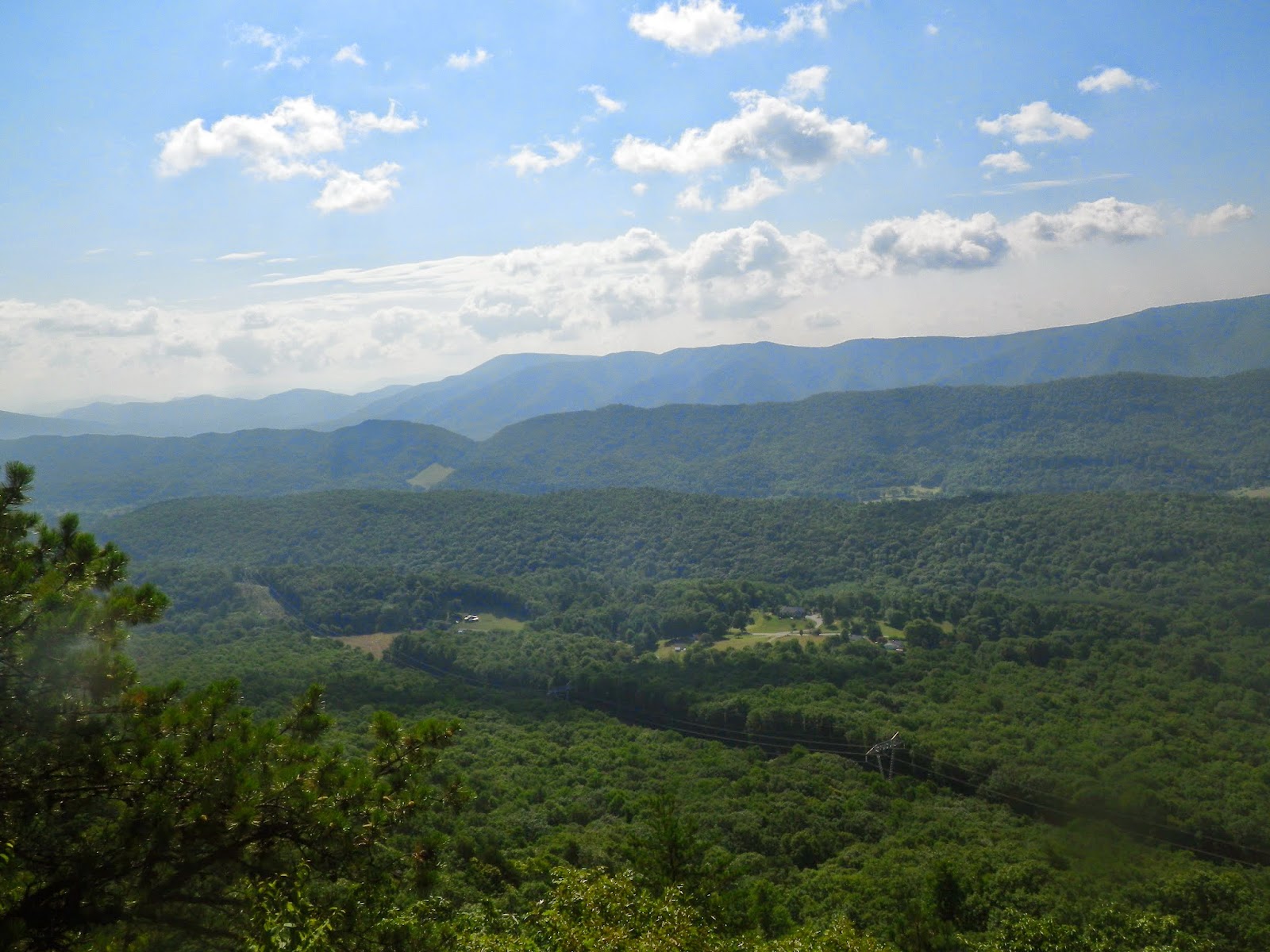
On the very top of Sharp Top Mountain one can see the Peak's otter Lake and lodge below. From here you can retrace your steps back to the trail head.

Psalms 72:3 "The mountains shall bring peace to the people, and the little hills, by righteousness."

Saturday, October 4, 2014

Dragons Tooth

Dragon's Tooth is the second most popular hike in Southwestern Virginia. It is more physically demanding than nearby McAfee's Knob which is a short distance away. On the day I hiked Dragon's Tooth the trail head parking lot had twenty parked cars, and the parking lot to McAfee's Knob had about 150 cars. Dragon's Tooth is a five mile round trip hike from the trail head parking lot.

As I walked up the path from the parking lot I was greeted by a patch of ripe blackberries.  This area is known for the black bear sightings, and I wondered if I would be seeing any sampling blackberries along the trail.


The trail is well marked by a blue blaze painted approximately six feet from the bottom of tree trunks. Although the trail is well worn from the many hikers who take the challenge to hike Dragon's Tooth, it is well-maintained in an attempt to stop erosion of the soil from occurring.


As you hike along the trail you will cross many low water bridges built to span several of the wet weather drainages at the base of the mountain.


During heavy rainfalls these small wet weather streams can become raging drainage ways that can take large boulders and fallen trees down the mountainside.


A short distance up the trail you will see yellow blaze trail markers leading to the left showing the  beginning of the Boy Scout Trail. This side trail takes you to the Appalachian Trail and another way to climb Dragon's Tooth.


A series of water bars are placed along the trail to direct stormwater across the trail and into the woods, rather than allowing the water to increase its erosive force down the trail. 


Although the water only stays a short time in pools along the wet weather stream you may see some aquatic insects and crayfish enjoying that time.


The trail is steep but manageable by the many switch backs to the top.


Rock steps are constructed where switch backs are not constructed.


I like to try to identify the plant life along the trail. This plant is a young sassafras tree. It is recognizable by its three distinctive leaf shapes. In the winter the sap is stored in the roots for new growth in the spring.  


Many varieties of maple trees are found all along the trail.


The mountain ash has a leaf much like the red maple and it is known for its distinctive green lines running down the tree branch . As I was looking at the different trees I heard a noise as if someone was shuffling through the dry leaves and looked up to see a big black bear and before I could take his picture he was gone.


Poison ivy is known to grow all along the edges of the trail, and the oil from the leaf and stem causes a skin rash. 


If you take the Boy Scout Trail you will pass through an area where pine needles cover the path from a  pine groove.


Before too long you will come to the Appalachian Trail marked with a white blaze. The Dragon's Tooth Trail and The Appalachian Trail become one from here to the top. A map is provided on the post to help make sure you go the right direction.


There are areas where you can stop to view the beautiful 
valley below.


You know you are getting nearer the top of the mountain by the large out croppings of solid rock.


Even though you see large rocks you are still aware of nature's force of erosion by seeing the sand along the trail. The force of wind, water,  freezing, and thawing cause the decay of rocks into sand.


Closer to the top the trail gets very rocky and more dangerous. A sign warns you of the danger in hiking over a steep and rocky trail.


You will walk along narrow ledges and come into contact with loose rocks.


Where there are no trees to mark the path the correct way is marked by white paint on the rocks.


There are areas where there are no easy hand holds and here metal steps are provided.


In other areas where metal hand holds cannot be provided, you are left to rock scramble over these areas.


You know you are at the top when you can turn around and look between the large rock boulders that form the Dragon's teeth and see views of the valley and mountains below.


Once at the top you can make a turn around of about 360 degree view of the valley below.


There is no question in my mind that God created the beauty in all of what we see.
Isaiah 55:12 - You will go out in joy and be led forth in peace; the mountains and hills will burst into song before you, and the trees of the field will clap their hands.


Sunday, July 6, 2014

No Worry Family and Friends' Fun

Have you ever wished that you could attend a get together with friends and young children without the worry of hearing bad language, alcohol drinking, smoking, or gossiping? 

     This month I attended a father and daughter weekend canoe trip with friends from several local churches. I am a grandfather, and I was invited to participate by my son-in-law and granddaughter.          
     Six fathers and their young daughters, ages nine to eleven, and I floated down the James River headwaters, stopping overnight at a campground and then continuing downstream to a take-out point.  The girls and fathers set up camp and cooked meals. Each canoe contained one father in the back and his daughter in the front. The fathers fished while the daughters paddled along the river. The James River flows fast enough along this section so that it did not take a lot of effort to navigate downstream. Occasionally, some of the girls would jump into the water for a refreshing dip in the river.
     The rapids were easily-navigated whitewater Class I's and II's.  Fathers provided lunch from the coolers carried in their  canoes. Sometimes the canoeist would turn upstream and try to surf the  rapids.
     On Sunday morning we had an informal worship service thanking God for the opportunity to take the trip and the blessing, as well as responsibility, that fathers have in raising their daughters in Christian love and understanding.
    The additional blessing for me was that the trip was free of alcohol, drugs, bad language, swearing, and inappropriate dress. Unlike work family picnics that I have attended in the past, this activity was a breath of fresh air--literally as we enjoyed God's outdoor magnificence, and figuratively, as we enjoyed fellowship that would please our Lord.  Before, I was afraid to attend these type of activities because of what my children might hear or see. What a delight to be free of all of that worry and to be with Christian family and friends.  I thank God that He provides times like this because of His great love and care for us and our spiritual and emotional needs.  He knows us so well.
     Proverbs 22:6 reminds us, "Train up a child in the way he should go," (NIV).  I know that this weekend will remain in the hearts of these girls--having enjoyed fellowship with their earthly fathers, who are training them to draw closer to their heavenly Father, as well.

My Native Ultimate 12 foot Kayak


                         Headwaters of the James River near Roanoke Virginia


Fathers and their daughters paddling along the river


Paddling and fishing along the James River


Wednesday, January 22, 2014

Growing Older Along The Trail

I am a  older hiker, and I find it harder physically to continue hiking the trail. My bones ache with every mountain I climb, and I find myself staying in the sleeping bag longer each morning. But I continue to hike because I am inspired by the beautiful mountain views and wonder of God's creation.  I rest often on rocks or fallen trees knowing that there are hundreds of hikers that have passed along this same trail before me, and I think of the thousands of people who are unable to experience what I am experiencing. I recently met an older lady who was able to express the feeling I have when I hike along the trail.  Phyllis V. Brokaw wrote this poem in 2009 and has given me permission to share it with you.


                Out in the Woods with God


Have you ever stood in the midst of the woods
and heard the forest talk;
Have you been all alone as the tree tops swayed
to a music all their own?
Have you seen a bird fly from limb to limb
as she sweetly sang to you?
Have you heard a brook as it flowed o'er the rocks
lend its rhythm in cadence, too?
Did you notice how leaves as they gently fall
form a beautiful carpet for you?

It's a wonderful thing when God's nature provides
an oasis away from life's storms;
Take a day away in the woods someday
when tired and weary and worn.
It's a special gift and an awesome reprieve
out in the woods with Him;
If you stand very still, I am sure that you will
hear the still small voice within;
You'll draw from the silence the peace that you seek
and know you've been touched by the King.

If you'll stand very still in the turmoil of life 
and heed to that voice within;
You'll be led the Spirit in wisdom and grace
in the midst of the chaos and din;
Then you'll find all you need of courage and hope
if you'll travel life's highway with Him.


Wednesday, November 27, 2013

Hiking One of the Most Traveled Sections of the Southern Appalachian Trail - McAfee's Knob Loop

McAfee's Knob


The McAfee's Knob hike begins at the junction of the Appalachian Trail and Route 311, just outside of the city of Roanoke, Virginia. It is approximately 3.9 miles long creating about an 8 mile round trip. An old fire road parallels the first 3 miles of the trail making the trail to the top very accessible by just about everyone. The trail overlooks the valley from Catawba Mountain. It begins at Route 311 and immediately ascends a stone stairwell to a series of switchbacks that reach to the crest of a narrow steep ridge passing by the Boy Scout and Catawba shelters. Water supplies at these shelters and along the trail may be seasonal and cannot be relied upon for drinking water. Therefore hikers should carry their own water for the trip. The mountains here sit on the edge of a giant sandstone out-cropping known as the Pulaski Fault. A series of narrow foot bridges carry the hiker over some of the rock ledges of the fault. Depending on the season the trail is dotted with a wide variety of flowers and trees. This area is known for its mountain laurel and redbud trees. Because of its hanging seedpods, the redbud is considered to be a member of the pea family. It is also called the flowering Judas tree. Some people believe it is the tree Judas Iscariot hanged himself from. At the top of McAfee's Knob are several large outcrops that jut out from the mountain side. Views from the top are breathtaking of nearby Tinker Cliffs and Catawba and Roanoke valleys.


 Hundreds of people hike this trail each year.  Wear and tear from hikers and downed trees from severe weather takes a toll on the trail.The large volume of hikers and the sandy soil causes the trail to require lots of maintenance.


                              Hiking along the ridge of McAfees Knob Trail.


                                    Wooden bridges over sandstone outcrops


Tree falls across the wooden bridge.


A soil replacement trail for the destroyed wooded bridge


View of Catawba Valley from the trail


A sign announcing the end of the trail and top of the mountain


McAfees Knob

Psalms 121:1-2  I will lift up mine eyes unto the hills, from whence cometh my help.  My help cometh from the Lord, which made heaven and earth.


Friday, May 3, 2013

Hiking the Appalachian Trail in Pennsylvania Northbound from Swatara Gap to the Blue Rocks Family Campground

Hiking History

I have talked with many Appalachian Trail thru hikers, and each of them have told me how hard it  is to hike the rocky areas of the AT in Pennsylvania. In the past I have envisioned hiking the entire AT in sections at my own walking rate. I am over half way finished hiking the entire AT and I have recently come to the realization that at age 70 the vision may not become a reality.  About 20 years ago I was diagnosed with severe knee loss of cartilage due to many years of overuse and abuse running marathons and ultramarathrons. Three doctors told me that I needed immediate knee replacements in both knees and that my long distance outdoor activities of running, bicycling and walking were a thing of the past. I refused to give in to an inactive life of  being a couch potato. I vowed to become even more active than before the doctors' diagnosis. I knew that running was no longer an option, but bicycling and long-distance walking seemed real and viable to me. I began bicycling to and from work and started hiking small sections of the AT. My first real test was to bicycle 470 miles of the Blue Ridge Parkway. I completed the trip in six days and since then I have not looked back.  I have completed many 100 and 50 mile bicycle rides, bicycled to and from work for ten years, as well as  hiked portions of the AT and the Continental Divide Trail. Last summer I hiked Rim to Rim of the Grand Canyon. I thought that I would have enough time to finish hiking the AT before I physically would have to quit.  My latest adventure was to hike 75 miles on the AT from Swatara Gap to Lehigh gap in Pennsylvania. I divided the hike into two parts. The first part was from Swatara Gap to Port Clinton and the second from Port Clinton to Lehigh Gap.

Swatara Gap to Port Clinton Hike

At Swatara Gap a hiking friend joined me as an encourager and as a safety precaution against me falling and being left all alone injured on the trail. The AT is a well-maintained trail.  Hikers have a very small chance of becoming lost in the woods. The chance of injury comes from falling while walking long distances on basketball-sized wobbly rocks up and down the mountains with a 35 pound pack. During the month of April in Pennsylvania there are only a few thru hikers on this portion of the trail and an injured solo hiker may lay unattended for hours or even days. We hiked together for three days before he had to quit to attend the Penn Relays in Philadelphia. 

Along the trail we passed groups of young couples trying to find suitable areas to view the meteor showers expected that night.  Our first stop after 11.2 miles was the 501 Shelter. The 501 Shelter is one of the only shelters that are enclosed with a roof and four walls. The shelter is maintained by a caretaker who lives in a house less than 100 yards away. The shelter ceiling is composed of  a skylight covering the entire roof. If we had not been so tired we could have viewed the meteor shower without getting out of our bed. It was great to be able to sleep inside without the worry of bears or other larger animal visitations looking for our food. Of course, one has to worry about mice in the shelter trying to sneak a morsel of food or steal something to line their home from a chewed piece of coat or sleeping bag. It was 29 degrees that morning, making it hard to roll out of our sleeping bags to starte on the new day's hike. I dined on a breakfast cookie and some hot instant coffee. I usually pack only very light items for a long hike, but my pack was much heavier this trip. Although the mountains of this section of the AT in Pennsylvania are only 1500 feet high they are challenging because of the very rocky trails.


The next day we hiked to the Eagles Nest Shelter, approximately 13 miles. This hike was not  very scenic. There were rocks, trees, and shrubs along the entire day's hike. The shelter was three-sided with a roof. Another hiker was already at the shelter nursing a smoky fire. After three washes my jacket and clothes after three washes still smell like campfire smoke. The other hiker was in his late forties and appeared to be an experienced hiker. His destination was some place in New Hamphire, and I hoped we would not be seeing much of him further down the trail because his snore sounded like a wounded bear all night long. My friend and the new hiker hiked a lot together the next day. They hiked at a faster pace than I did, but my friend stopped many times to let me catch up with him. You should never hike solo along the trail in areas that can be very dangerous. We saw very few other hikers along this hike. We never saw the other hiker again. The next day's hike would be nine miles into the town of Port Clinton. This hike was very much like the last day's hike without any exiting views.


At one point my friend missed a turn in the trail, and I managed to get in front of him. It was a pleasant surprise to see him coming up behind me.  We walked together for awhile, and I was in front of him when I heard a large thump. He had fallen on the trail on some rocks, but he jumped up and exclaimed that he was not hurt and limped onward. I wonder while in private that night did he secretly survey his bruises and knots from the fall.  The trail coming into the town was almost straight down without any switchbacks for about a mile. It was very hard to keep our balance while going downhill, stepping over large rocks with a heavy pack.  I stayed in the town at the Port Clinton Hotel. The Port Clinton is an old coal town.  


There were many historic markers documenting the town's history. I believe the hotel was as old as the town. The hotel lobby was also the bar, and the dinning area was just off the bar. My friend decided to have lunch with me before he was shuttled back to his car in Duncannon, PA. He ordered meat loaf and stuffed mashed potatoes. Stuffed mashed potatoes are mashed potatoes with pieces of celery, onions, bread crumbs and other things (who knows what else). I had a cheeseburger and a small french fries. The small french fries were enough for three people. The large fries must have been made from ten large potatoes. The people who ran the hotel were very nice. My room was one of six rooms upstairs. The door was locked by a dead bolt since the door knob lock had been shattered sometime earlier. The bathroom was at the end of the hallway. The bed mattress reminded me of one of those sway-back horses I used to see during a family country drive when I was a child. I did not care about any of these things because it was a chance to sleep in a bed without anybody snoring next to me. 

Port Clinton to Lehigh Gap Hike

I planned to continue solo hiking for four more days to Lehigh Gap. Since I had come down in elevation to Port Clinton that meant I had to go back up the same distance to the trail again. Somehow the breakfast cookie I ate did not have that lasting energy it had the previous morning. There were many great views of the valley below on the way up the mountain.


At the top the rocks became almost unbearable to walk on and I found myself taking many breaks. This trail had more day hikers. They did not have a problem telling me how difficult the trail is since it is lined with softball-sized rocks for miles and miles. The more hikers I encountered the more they stressed how dangerous the rocks were along the trail. The right kind of encouragement goes a long way, and the wrong kind makes a good day turn bad. My day's destination was a family campground a mile off the trail. If the side trail to the campground was  only a sample of what was in store for me the next day I was mortified. At the end of the hike I checked into the Blue Rocks Family Campground. The campground was named Blue Rocks because there was a large rock field stretching from near the top of the mountain to the campground.


The rocks are thought to be deposited from glacier deposition during the ice age. The pictures confirmed to me that more rocks would have to be crossed the next day.


Graphic pictures of the dangerous trail rocks posted on the check-in wall was the straw that broke the camel's back. I made the decision to go no further and made arrangement's for my shuttle pickup for the next day.  I had envisioned starting the hike the next day and only going half way down the trail before falling and having to call for help. I felt that I had reached my limitations for a safe hike and had to call it quits. Part of hiking is making sure you are safe in all that you do along the trail. 

After Thought

I believe that I need to look at each section of the AT that I have not hiked yet and pick the hikes that are the most representative of each state section. I will not rule out slack packing or day hiking some of the more challenging sections.  Let me know your ideas on my plan and post then in the comments section of this blog.

Psalm 40:2.............God set my feet on a rock and gave me a firm place to stand.