Tuesday, December 1, 2015


Appalachian Trail Wild Flowers and Selected Plants 

There are many plants found on and around the Appalachian Trail. The following photos are a small representative of them.  Because of the ecology, the trail may be considered a deciduous tree forest. There are many insects and birds that aid in the production of plant species. For example, bees and other flying insects help pollinate  flowers and, many birds eat the plant seeds in one area and later "poop out" in another area.


This flower, known as Smooth Gerardia, Gerard laevigata, is found in dry woods among oak trees, usually from July to September.  It is a bright yellow funnel or bell shaped flower about one to one and a half inches long. It is called "false yellow foxglove" and it is fairly common in the southern mountains.


The Spring Beauty . Clayton Virginica, has white to pink flowers with deeper pink veins. These flowers are first to show up during the spring and only last for about three days. Deer and moose as well as chipmunks, mice, and people have found the roots to be quite delectable and nutritious.  When eaten raw the roots taste like radishes and when cooked taste like potatoes.


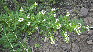
Chinese clover, Sericea lesoedeza, is a perennial legume.  It is herbaceous with a woody stem.   A small cluster of flowers is located on a branched stem, on the average it grows with a three feet tall stem surrounded by small leaflets.  It flowers from July to October and is used for erosion control and feed.


Although hardwoods predominate the trail one will also see evergreens of pines growing in the background.  The white pine, Pinus strobes, has needles for leaves clustered in bundles of five,  shaped like a "W."   It grows in dry, higher elevations and rocky ridges. 


The Virginia pine, Pinus virginiana, is found in large numbers in the upper Coastal Plain and hilly areas of Virginia and surrounding states.  The needles grow in bundles of two and form a "V." They vary from one and a half to three inches in length.


The sugar maple, Acer saccharin, is often called the sugar tree and is found in the cool slopes in the mountains.  It is usually a slow growing tree forming a dense crown for heavy shade.  The leaves are three to five inches across, pointed and with sparsely toothed lobes.   These leaves are responsible for the bright red colors in the fall.


Mountain laurel, Kalmia latifolia,is found in the wooded areas around rocky or sandy soils from New Brunswick to Ontario and south to Florida and Louisiana.  It has a very beautiful flower but is poisonous and should not be used for cooking.  It grows three to fifteen feet high.


Hair cap moss, Polatrichum commune, gets its name from hairs that cover a cap where each spore case is held.  It has a star shaped appearance because of the way the leaves are shaped on the stem.  It grows four to twenty centimeters tall.  The average life span is five years.  It lives in lightly shaded areas with moist acidic soil and sometimes in full sunlight.  It grows wild from granite outcropping to the coastal plain.  It is used by some people to make a tea to dissolve kidney and gall bladder stones.  It is also believed by some to be good for the hair as a rinse to straighten hair. In the past it has been woven to make baskets.


Wild geranium, Geranium maculatum, has lavender flowers with five petals (sepals) with deeply forked leaves.  It can be found in wood thickets and meadows.  It flowers April through June.


The fire pink, Silene virginica, has bright red long-stalked flowers in loose clusters at the top of a slender stem.  The flowers have five petals that bloom in April through June.  A common name is catch fly because of the sticky hairs that trap insects. 


The rue anemone, Anemonella thalictroides, flower has three leaves, each with three lobes, that form a whorl on the stem below the flower cluster of this six to eight inches plant.  The flowers are white to pinkish with five to ten petal-like sepals.  The flowers bloom from April through June.  It is found in open wooded areas. 


The large-flowered trillium, Trillium grandiflorum, grows eight inches to eighteen inches tall.  The color of the flowers ranges from white to deep pink.  It grows in rich foods and often in coves and on slopes.  The trillium goes through a long process to bloom.  The flower becomes pollinated and develops a berrylike fruit.  The seeds inside the fruit enlarge, and the fruit breaks open and fall to the ground on fertile soil.  The seeds are carried underground by ants where they spend two years, and then they break the surface and continue to grow for four more years developing leaves.  After a minimum of six years from the time the seeds touched the ground, a blossom will appear and the plant will continue to produce flowers for many seasons.  It blooms April through June.


White snakeroot, Eupatorium rugosum, has heart-shaped or triangular leaves and is very common in rich woodlands at high altitudes with snow-white flowers clustering August and September.  The plant has coarsely toothed-shaped leaves on a slender stem.  There have been some fatal cases of "milk-sickness" in man and cows that have been traced to the use of milk from cows that had eaten white snake.


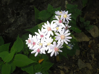
The small flowers  on the white aster, Aster vimineus, are August through October in dry to moist fields and meadows to shores.  It grows two to five feet tall.  The flower head is about a third inch wide and is arrayed in groups of fifteen to thirty.


Lady's thumb, Polygonum persicaria,  is made up of dense erect, oblong or cylindrical spikes of small pink or purplish flowers at the tops of simple stems.  The flower clusters are four mm long to two inches long.  There are no petals but the sepals are four to six and colored.  The fruit are seed like and glossy black.  It flowers in June through October alongside roads, damp clearings, and cultivated ground.


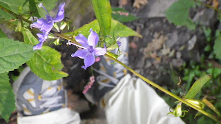
Tall bellflower, Campanula americana, has a stem one to four feet in length.  The one inch flower has five light blue petals in a star shaped pattern.  It flowers June through September.   It is found in moist woods and on open slopes off the Blue Ridge Parkway and in the Great Smoky Mountains National Park.


Crested dwarf iris, Iris cristata, was named by the Greeks for their goddess of the rainbow. It prefers wooded slopes and ravines.  The pale to deep purple flowers are divided into parts.  The three petals are narrow and arching, and the three petal-like sepals are broader, curved downward. It is streaked with purple and are crested with white to yellow ridges.   It blooms from April to May.


Pale jewel weed, Impatiens pallia, flowers are a yellow coloration and side-turned sepal spur divided into two parts.  Because of its fruit it is also called snapweed and touch-me-not.  The seeds mature inside a coiled capsule and when ripe explode out of the capsule when touched.  Some people believe the sap of this plant will ease poison ivy itch.  It is found in moist woods, gaps, and coves.  It blooms from June through September.


Rock tripe lichen, is found growing on the rocks throughout the trail. Lichen is a combination of an algae and a fungus.  The fungus aids in anchoring the algae to the rock and the algae helps provide nourishment for the fungus.  In a survival situation you can eat the lichen after a series of boiling and water changing.  It might be a little on the chewy side.


Bloodroot, Sanguinaria canadensis, is usually two to eight inches tall, with one leaf usually folded around the stem.  The majority of the plant is found underground, and that is why it is called bloodroot.  The plant may be poisonous if eaten.  It is a skin irritant to some people.


Sassafras, Sassafras albidium, is a small aromatic tree usually not over forty feet in height an a foot in diameter.  It is common in dry soils and is the first to repopulate abandoned fields.  The seeds are spread by birds.  There are three different leaves on the tree -- a three lobed, single lobed, and a dual lobed.  The wood was originally used for posts, rails, and boat-building.The oil from the bark and roots was used to flavor candles.


The mountain maple is really an ash tree but the leaves resemble a large maple leaf.  It was originally classified as a maple but later reclassified as an ash.  It is very unique because it has long longitudinal white stripes leading up the plant stem.  You may see this tree often along the trail. 


The galax, Galax aphylla, is ten to twenty-four inches tall with heart-shaped shiny leaves.  It is found June through July, but you have to be very observant to find it along the trail.   It may be found in open woods and rocky slopes.


The tulip poplar, Liriodendron tulipifera, is better known as the tulip tree or yellow poplar.  It has a yellowish flower as well as the heartwood of the tree.  It is one of the largest and most valuable hardwood trees.  It grows in deep moist soils usually along streams and the lower mountain coves. Trees may grow from sixty to one hundred feet tall and three to four feet in diameter.  Bees are known to make honey from their very large flowers.  The wood is cut into lumber and used for veneers and furniture.


Ferns like the Christmas fern, Polystichum acrostichoides, grow to a height of one to two feet and spread one to two feet.  They are non-flowering and grow in part shade to full sun.  The soils may have dry to medium water content.  The leaves are long green blades with many leaflets shaped like Santa's boots.  This is one of the only plants that tolerate rabbit, deer, drought, heavy shade, erosion, and shallow rocky soils.


Poison ivy, Toxicodendron radicals, leaves are all in groups of three on the stem or vine.  The leaves are often shiny and green, the vines are covered with hairs.  They bloom in May through June.  All parts of the plant are poisonous and touching causes severe, weeping rashes on people who are sensitive to the plant oils.  


Fringed polygala or gaywings, Polygala paucifolia, with three-quarter inch reddish or purple flower has a center tube and two tubes perpendicular to the center tube.  It blooms in April through June.  They thrive in woods with acid soils and small colonies up to elevations of 2,500 feet.  These flowers were once considered as members of the milk wort family and believed to be able to stimulate the increase of milk in cows, hence the scientific Greek name poly and gala or much milk. 


Jerusalem artichoke, Helianthus tuberosus, the toothed egg-shaped upper leaves are alternate and the lower leaves are opposite on the stem.  The flower is yellow and blooms in August thru October.  The plant does not come from Jerusalem and is not in the artichoke family.   The Native Americans and colonists ate the tuber of this plant, it sometimes can be found in supermarkets.


The red maple, Acer rubrum, is a medium sized tree--quick growing and relatively short--lived.  It is used as a shade tree but is inferior to other maple trees.  The bark is smooth and light to dark gray in color. The normally green leaves turn bright red in the fall.  The fruit consists of pairs of winged seeds about one half to one inch long.  The wood is a soft close--grained and rather weak light brown.  It is used to manufacture furniture, wooden ware, and for fuel.


Columbine, Aquilegia canadensis, reminded people of a flock of hovering birds and so it earned the Latin name columba or "dove."  The flowers long curved spurs resembled an eagle's talons or Aquilegia Latin for eagle.  Bees just nip the flower tip to drain the nectar out and hummingbirds love these flowers, as well.  It was believed that juice from a fresh flower was used to reduce a swollen liver from jaundice or to cure measles or small pox.  The plant may have a soothing effect on pain.  It blooms from April thru July.  The flower may be red or yellow.


Virginia spring beauty, Clayton virginica, has two long lanceolate leaves opposite each other on the stem.  The one--half inch five petal flowers are white with pink lines.  It blooms from March through May and is found in moist wooded areas.  The flowers only last three days.  Deer and moose browse on the tiny flowers, but humans and small animals like to eat the roots.  The roots taste like radishes when raw and like potatoes when cooked. 


Star chickweed, Stellaria puberal, is known for its white flower but is valued by birds,animals, and humans.  Birds find its seeds to be quite delectable so it is also known as birdseed.  Grazing animals are drawn to it because the plant is a source of copper.  European markets sell it because it is considered a very tender edible green and is added to many salads.  It is also high in vitamins A and C--helpful treatment for scurvy.  It has also been known as a poultice for abscesses and boils.  According to folklore the sun will be shining bright if the blossoms are spread out to their fullest.  If the flower begins to close that means rain is coming.

PSALMS 103:15--As for man, his days are as grass: as a flower of the field, so he flourisheth.







Friday, November 6, 2015

Appalachian Trail Hike Over Blood Mountain

I think often of individuals who are not physically able to hike but wish they could take one step on the Appalachian Trail and feel great about it.  That's why I do not let any type of weather keep me from doing it.  Rain, snow, sleet, hail do not stop me from putting one foot in front of the other.  Thunder and lightening are the only factors that will make me stay home.
 I usually hike in waterproof trail shoes, baseball hat, and rain coat.  On rare occasion I will hike in gators, rain pants, and maybe an umbrella.  As strange as it might seem, it is not hard to carry an umbrella and walk with a trekking pole at the same time.  I may look funny, but I stay very dry.
Years ago my wife bought me a Golite umbrella, but I never had the nerve to hike with it for fear of being called  a wimp.  However, I have used it during snow storms and heavy  rainfalls.  It feels really good to keep the rain from stinging my face and  the cold water from running down my neck and back.
While hiking up Blood Mountain I passed seven thru hikers who all liked the idea of the umbrella.  All seven looked as if there was not a dry spot on their body. I stopped and chatted with all of them about what might be next after they finished the trail.  The hikers had one night left on their quest to finish the 2,100+ miles of the Appalachian Trail (AT).
I am a section hiker and am not physically able to hike more than 100 miles at any one time.  As part of a southern vacation my wife agreed to help me hike a 10.7 mile section of the Appalachian Trail from Woody Gap to Neel Gap.  She dropped me off at the trail head and then picked me up that evening at the end of the trail.  Many times she has been the shuttle guide for drop off and pick up.  Most men my age are not interested in spending time hiking or backpacking any trail.  The picture below was taken at the beginning of my hike in the Chattahoochee National Forest Neel Gap by way of Blood Mountain in pouring rain.  Blood Mountain is the highest peak on the Appalachian Trail in Georgia at 4,458 feet.  There are several theories for the name Blood Mountain. One theory is that it is the spot where the Cherokee and Creek Indian tribes had a big battle for territorial land rights and thousands of indians died. Another theory is that there was a mass murder of colonists in this area by indians, and the last theory is that it is named Blood Mountain because of the red colored lichen on the rocks.


The umbrella, gators, rain jacket and waterproof shoes kept me dry for most of the hike.


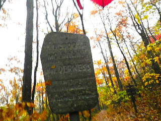
An old sign announcing the beginning of the Blood Mountain wilderness where the highest mountain on the Appalachian Trail in Georgia is found.


The trail is clearly marked with the white blaze.  It is hard to get lost on the trail because if you miss a white blaze you can turn around, and you will more than likely see a blaze making the other hiking direction.


There are trail directional signs located in areas where other trails cross the AT. The trail sign indicated that my hike was 11.7 miles long.


After thousands of hikers have hiked the AT,  the trail has become like an elongated bath tub.  All the rain and snow that falls stays on the trail and all attempts to make the water run off the trail by using water bars is almost useless.  The water was two to three inches deep for most of the hike. My waterproof shoes did a great job keeping my feet dry.


The trail was posted with bear warning signs due to all of the bear sightings at the camp areas.  The most bear activity was in the spring and bear canisters were advised for campers/hikers.


A stream restoration project was being performed at the base of Blood Mountain on a small creek about two feet wide and caution was encouraged by hikers.


It was October and the maple leaves were in full color.


There are very few four-walled shelters on the AT and Blood Mountain has one of them.  It was built in 1934 by the Civilian Conservation Corp.  I looked inside and it was dry but very damp with concrete floors.


The privy was an above ground structure called a composting toilet.  There was no privacy for all viewers could see you sitting from the waist up.


At the top there were shear rock slabs covered with wet leaves. That made it very dangerous to walk.  Two of the last three miles of the hike were on extremely slippery rock slabs and steps.


The trail leading down the north slope was shaped like a elongated rock bath tub.  The pounding rain and driving winds made it very difficult to walk down the steep slope.


Toward the bottom of the hike the trail was composed largely of steps made out of layered rock.  The down step was about twice the drop of a normal stair step in a house.  The impact to the knees was very stressful.  With every step I could hear mentally my couch potato friends say, "That is why we do not hike."

At the bottom of Blood Mountain at Neel Gap is a large backpacking store and hostel called the Mountain Center, the only place on the AT where you actually pass through a man-made rock structure.   You can restock any of your needs as well as have a bed, towel,  and hot shower all for seventeen dollars.


Isaiah 40:4 - Every valley shall be exalted, and every mountain and hill be made low: and the crooked shall be made straight, and the rough places plain:


                       Winter Bicycling 

                                     The Bike Ride


I go on an outside activity just about any time of the year.  If someone wants to go I am willing to venture out with them.  I have several friends in Richmond, Virginia who share that same desire to be in the outdoors.  
I was recently invited to go on a bicycling trip around Richmond one Saturday morning.  For many years I lived in the Richmond suburbs and worked in  the downtown area.  I bicycled to and from work every day for fifteen years in all kinds of weather.  Many times I cycled the twenty mile trip during  cold, rainy, snowy, and icy conditions.  I was prepared to take on the January winter cycling challenge. 
We started at 6:30 AM on Saturday with the temperatures near twenty degrees.  It was still dark and headlights and tail lights were a necessity.  It is important to check the condition of your bicycle before you start.  I did not check my bike before we started peddling and found out that my shifter cable to my rear derailer had jammed in a mid-range gear, and I had to peddle the thirty miles with what amounted to riding a side walk bike.  Fortunately, we did not have to go up too many hills, I could stand up and pump up those hills.  During the ride we averaged ten to twelve miles per hour which made a chill factor below freezing.  Richmond had just experienced a week of snow and freezing rain.  The roads were covered with sand and chemicals used to treat them for safe automobile travel.  When you ride on a road like this your tires pick up the road treatment, and at the end of your ride your chain is coated with lots of sand and debris.

                                             Gear

Bicycle - Start with a bicycle in good mechanical condition and with a working headlight and tail light if you will be starting before daylight.  I prefer using toe clips rather than snap on pedals.  I have had several accidents riding in the city using both types of pedals, and my injuries have been less with the toe clip cage type of pedals.  I have installed a small bicycle rack over the rear tire to carry extra gear and to stop the splatter from the rear tire onto the back of my clothes.  On my down tubes there are two water cages for my water bottles and for carrying extra tire gear.  An insulated water bottle will  keep the water from the freezing during chill factors.


Cycling tights - Cycling tights go over your regular cycling shorts. The tights are normally a synthetic tight-fitting fabric to give you and extra layer of clothing to shield the cold wind. With temperatures near freezing the tights are built with a wind proof front fabric over a warmer breathable rear fabric.  Overlapping extra folded material at the knees allows for freedom of movement while peddling.  A draw string at the waist keeps them from slipping down, and zipped bottom cuffs make it easy to remove without taking your cycling shoes off.


Front 


Back

Cycling base layer - A base layer of a tight fitting non-cotton breathable synthetic long sleeve shirt allows the sweat to wick away from the body. A half zippered neck allows for venting heat away from the body. 


Base long sleeve non cotton layer

Top layer - A short sleeve half-zippered wool top layer Jersey wicks the perspiration away from the body.


Top layer wool cycling jersey

Winter cycling coat - A winter cycling coat usually consists of a wind resistant fabric in the front and a breathable synthetic fabric in the rear.


Reflective wind breaker- May be worn outside of the cycling coat.


Reflective vest - May be worn in place of a jacket in warmer weather.


A balaclava - May be worn to protect the face from wind burn.


Neckerchief - A neckerchief is sometimes used to protect carotid artery in the neck from the cold.


Toe clip hoods - While cycling in the cold your toes do not get good blood circulation. You can buy a small hood that you Velcro around your toe clip to protect your toes from the severe chill factors.


Touring bicycling shoes - No Snap-ins cleats. It is a good idea to wear cycling shoes that you can walk in, in case you have bicycle malfunctions.  In that way you can walk to a near by house or business.


Socks - The proper wool socks are important because you do not want them to be too tight and restrict the blood flow to your feet.  A silk inner sock and a wool outer sock should be enough protection to guard against numb feet from the cold.


Neoprene overshoes - These are covers available to help keep your feet warm. The shoe cover goes over your cycling shoe,  insulating your foot from extreme cold due to very low chill factors.


Mirror - A mirror is essential in order to see approaching cars from behind you.  It may attach to the handle bars or to the side of your helmet.


Tool/repair kit - Tire changing tool, extra tube, tire patch kit and some way to inflate the tire would be important to have in your kit.


Contents of tool/kit - Be sure to include a CO2 air pump, extra tube, tire changer tool.


Extra tools - You may also carry some extra tools such as an adjustable wrench, tape,  and bungee straps


Water bottle/snack - Pack at least one water bottle for rehydration and a protein snack/power bar.

The pictures/information above include most of the equipment that I carry for a bicycling trip in the winter. 

John 15:11 - These things I have spoken unto you, that my joy might remain in you, and your joy might be full.

Tuesday, August 25, 2015


A Hiking Trip to Springer Mountain, the Southern Terminus of the Appalachian Trail

      A little over 3,000 people worldwide attempt to thru hike the entire 2100 miles of the Appalachian Trail (AT), Georgia to Maine, every year, and only about 300 succeed in their quest.  They begin the hike for many reasons--a loss of a loved one, divorce, time between schools, a time to find oneself, loss of a job, recent release from the military, graduation, and maybe just because the trail is there.  The cost ranges from a frugal $1,500 to around $3,000 for restocking of food and supplies along the trail. Most hikers prepare ahead with planned stops where supplies are mailed to local post offices along the trail.
     Many hikers hike with friends or pair up with solo hikers along the trail.  The trail goes a lot faster if the hiker can share experiences as he/she log the miles.  The average hiker who finishes the trail does it in about four to seven months.  Most of hikers begin in late February or  early March in Georgia so they can beat the winter snow closing of the trail in Maine.  It takes a very dedicated and physically fit person to hike the entire trail at one time.
     I chose to hike the 8.6 mile section of the trail from Springer Mountain to Hightower Gap (USFS 42).  I hired a local man to shuttle me and my day pack within a mile of the top of Springer by way of a United States Forestry Service (USFS) fire road.  The total hike was 9.6 miles with the addition of the extra mile to get to the beginning of the Appalachian Trail. 
     After hiking a mile I reached the rock overlook on the summit of Springer Mountain at elevation of 3,782 feet--the southern terminus of the Appalachian Trail.  I am told that at the top there is a  rock outcrop with excellent northwest views of the Cohutta Mountains, but the day I hiked it was cloudy with light rain and no views at all.  There were two bronze plaques that marked this point as the terminus of the AT.  The first plaque was made by the Georgia Appalachian Trail Club (GATC) in 1933 and was set in stone.  The second plaque placed by the USFS was next to the last white trail blaze and showed the route of the AT.  At the summit along with white blaze markers there are blue blazes marking the 8.1 mile approach trail from Amicalola Falls Park.


The First Plaque Indicating the Southern Terminus


The Second Plaque and White Blaze Marker

     Descending Springer Mountain I passed along a rocky trail sparkling with bits of mica, blueberries and azaleas.  At the 0.2 mile point I crossed a blue blazed trail leading to the Springer Mountain shelter and another white diamond-marked trail called the Benton MacKaye Trail (BMT).   The shelter was built in 1993 and has a sleeping loft, a picnic table, and a privy.  The BMT is named in honor of Benton MacKaye who first proposed the trail in 1921.  The BMT will, when finished, run from the Cohutta Mountains and the Cherokee National Forest to the western end of the smokies.


The Benton MacKaye Trail Marker

     The AT continues down hill passing on and over large boulders covered with rock tripe, a leathery lichen.  Because many springs seep along the trail, there are large blankets of ferns accompanied by spring flowering bloodroot wildflower. 


     At mile post 0.9 I passed by the point where my shuttle had dropped me off earlier.  A bird house welcomed the parking area.


     Again the white diamond-blazed BMT crosses the AT at mile marker 1.2.  The AT and BMT follow the same route until they split at the 1.8 mile marker.   The hiker has to be very careful to follow the right marker.  A white rectangle marker can at times look very much like a white diamond marker.  Georgia was heavily logged earlier and trails follow or cross many old logging roads. 


     The AT continues over Rich Mountain, crosses a stream at 2.1 miles, and turns left onto an old road with pretty blue wildflowers growing along the roadside.


Crested Dwarf Iris (Iris cristata) Greek Name for "Rainbow"


     At 2.5, miles a side trail leads to the Stover Creek Shelter, an older three-sided building cuddled among the hemlock trees.


     At 3.6 the trail crosses Stover Creek into a mixed hardwood and hemlock forest.  On a hot humid day the hemlocks give you a sense of winter time and Christmas trees.  At the 4.1 mile marker the AT and BMT cross an area called Three Forks, named for the joining of  Stover, Chester, and Long Creeks which flow into Noontootla, meaning "shinning water," Creek in Cherokee,  renamed Ocoee River in Tennessee.  


Stover Creek bridge crossing


Three Forks Crossing Trail Marker

     At the 5.1 mile marker the trail goes toward the Tennessee border and crosses a gravel road at 5.8 miles, which leads to the Hickory Flats Cemetery with a picnic table and a covered pavilion.  Hickory Flats was formed in the early 1900's as a dispersed community that farmed in "the flats".   Parts of an old church can be seen beside the cemetery.  A blue blaze on the left leads to Hawk Mountain Shelter--a fairly new shelter built in 1994 at elevation 3,619 feet.   The trail descends to Hightower Gap.  At this point two well-traveled forest service roads USFS 42 and 69 converge at the 8.1 mile marker, and my shuttle ride was able to pick me up.  All of the forest roads are unpaved and often can become rough and muddy.


Habakkuk 3:19 The Lord is my strength, and he will make my feet like hind's feet, and he will make me to walk upon mine high places.